Saturday 30 August 2014

Day 9: Lake Havasu City, AZ - Yuma, AZ

Yet another short day.  It seems old age is turning me into some kind of wuss - I've only scraped over 400 miles once so far.  Anyone with more time on their hands than is healthy can correlate the distance driven against the number of photographs taken, and then keep the information to themselves.  You should be grateful, especially if you like Bridges...

I am afraid I have started to think of last night's resting place as Lake Haversack City.  This is right up there with Cheesypeas Bay.  Or possibly down there.  You be the judge, and keep your conclusions to yourself.  One thing to like about the place is this: when approaching from the north, you pass a shopping mall just off the main road.  The road leading down to the mall is called "The Shops Boulevard".  I kid ye not.

It was a hot day from the off with the temperature exceeding a hundred Fahrenheits practically as soon as I'd fed the Mudstang some more motor-spirit.  At least yesterday it crept up on me gradually.  Both this afternoon and this evening saw brief bursts of 121 degrees, which is hot enough to melt your ears, and I wimped out at lunchtime and put the roof up and the air-con to 11.

The run down to Parker Dam is quite nice really, and unlike the Hoover Of That Ilk, it's practically deserted.  It has Roots Buried Deep into the Earth, or at least into the bed of the Mighty Colorado so although it's not as impressive on the surface as some of the Big Boys, it can boast some serious numbers to those who care about such things i.e. not me.
The country flattens out downstream of the dam and it's all agricultural and has roads with twenty miles long straights which nearly caused me to fall asleep.  I managed to find a suitably shady spot for a spot of rest, although it wasn't very quiet:
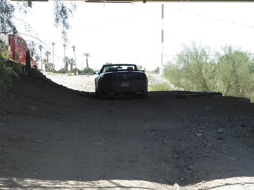
Mudstang and Englishman not going out in the mid-day sun...
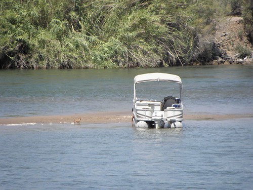
What you can't really see in the picture is that the horizontal line at the very top is the lowest extremity of a bridge span.  In this case the one carrying I-10 across the Mighty Colorado.  I am this: jealous.  Of the people mucking about on the water, whether on jet-skis or in 1000 bhp speedboats that make the dog's ears stream back horizontally.  Here is a man taking his dog for a walk in the middle of the Mighty Colorado:
(Small brown dog on sandbank to left of boat)
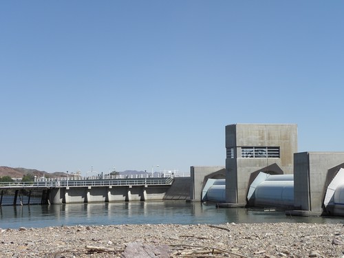
US-95 south from I-10 offered a different kind of ruler-straight dulkness as it climbs off into the desert and is flanked by US Army proving grounds such that a picnic area is also home to half a dozen different self-propelled guns and the junction with Imperial Dam Road is guarded by a couple of GBFO artillery pieces.  Imperial Dam is a low-rise affair and is for irrigation and water supply, and thus the primary reason why the Mighty Colorado is very much less mighty from here to the sea.  On the rare occasions when it retains enough water actually to make it to the sea at all.  You can't even see it from the back terribly well, still less from the downstream side, and all the other significant features of the Mighty Colorado around here are similarly concealed.  You can scarcely tell which of the shedload of channels is the actual river.
The upstream side of Imperial Dam.  Not a bad picture considering I had to hold the camera at arms' length above my head...
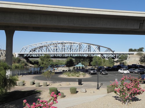
Again the land flattens bigwise and gets agricultivated.  It's like the Fens with date palms.  Nothing to see until you get to Yuma.  The bit of Yuma wot I is at is the site of the Yuma Crossing, which was a significant crossing point of the Mighty Colorado from pre-Columbian times and still has three bridges today.
Triple Bridgey Goodness: I-8, Penitentiary Avenue, railroad.  Latter complete with train!
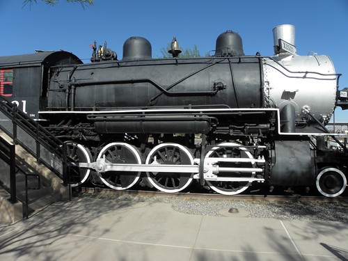
To commemorate the arrival of the horse-drawn Zeppelin railroad there is also this, smack next door to the hotel:
Southern Pacific locomotive 2521
I nearly gatecrashed a couple's wedding photos while snapping the above...  And I can see the Mighty Colorado from my window, or I could until it got dark.

On unresolved issues: There are two, viz.

  1. Where shall I go next?  I'm not enamoured of the prospect of going to the seaside on a Bank Holibob weekend, and
  2. Where I can I buy some fags?  I'm on the last packet of duty-free...

1 comment:

  1. 1. Wikipedia sez this is a thing to do in a car near-by:
    The Anza Trail (™) with handy motorcar map here:
    http://www.nps.gov/juba/planyourvisit/upload/Anza-Trail_Brochure-driving-map.pdf

    2. You know what my answer to this will be, right? :p

    ReplyDelete

O hai, spammers!

All comments are moderated so don't bother.

Kthxbai!