The last time I was in Page, in 2014, it was full of Germans. This time it's full of Japanese. As was Horseshoe Bend. Many of the said Japanese were wearing the kind of facemasks you see on the Tokyo underground, where they might conceivable be pointful. In the Arizona desert a couple of hundred miles away from the nearest motorway? Hmm. Actually, their use could have been down to the presence of the chap who, from his mode of apparel I took to be a tour guide and who, while walking down to the Horseshoe Bend overlook, emitted a cheery series of trouser coughs that sounded like a fridge door opening. I'm just worried that the Italians walking astern thought it was me...
I've worked out why I ate'nt been to Horseshoe Bend before, namely that it's off US-89 just south of Page and in 2014 part of US-89 south of Page was closed because Landslide so through traffic got routed down another road across the reservation. When you get there they relieve you of ten dollars and make you walk up and over a hillock, mostly on foul soft sand. They are doing a bunch of improvements, y'see, and all will be better when they're finished in April 2019. Oh, wait...
When you finally get to the overlook, you'll find one of these:

No, dolts, not the Japanese tourist, the gert big rock with the Mighty Colorado flowing round it. Yes, I suppose it's alright, but Goosenecks State Park has MOAR twisty-turny river and you can drive almost up to the edge and they only charge you five bucks to get in. And the ticket-selling lady at Goosenecks was far more cheerful too.
South down US-89 and turn right onto the imaginatively-named US-89A. I suspect that this was the original US-89 and only acquired its "A" after the Glen Canyon Dam bridge was opened in 1959. This drops downhill to cross the Mighty Colorado at Navajo Bridge, climbs gently across the not-quite-flat plateau wet of the river and then shoots skywards up to Jacob Lake. If you then turn south you can follow the road for a bit over forty miles, but then it stops on the edge of a big hole in the ground commonly know as the "Grand Canyon". This is the North Rim, which is far less touristy than the other side, wot is about 25 miles away as the raven flies but well over 200 by road. I came here in 2003 too and don't remember it being as busy as it was today, but then again, Battle Mountain was held in October in them days.
Anyway, you can wander about the vicinity of the Visitor Centre and gawp at the landscape, or head off on a side road to divers viewpoints, from some of which the Mighty Colorado is actually visible a vertical mile below, or you can have your car refuelled by Mick, who used to live in Thetford, because US Air Force.
 |
| Near the Visitor Center |
 |
| Rapids on the Mighty Colorado |
 |
| Pick the right spot and you can see the Mighty Colorado through the Angels' Window. How cool is that, eh? |
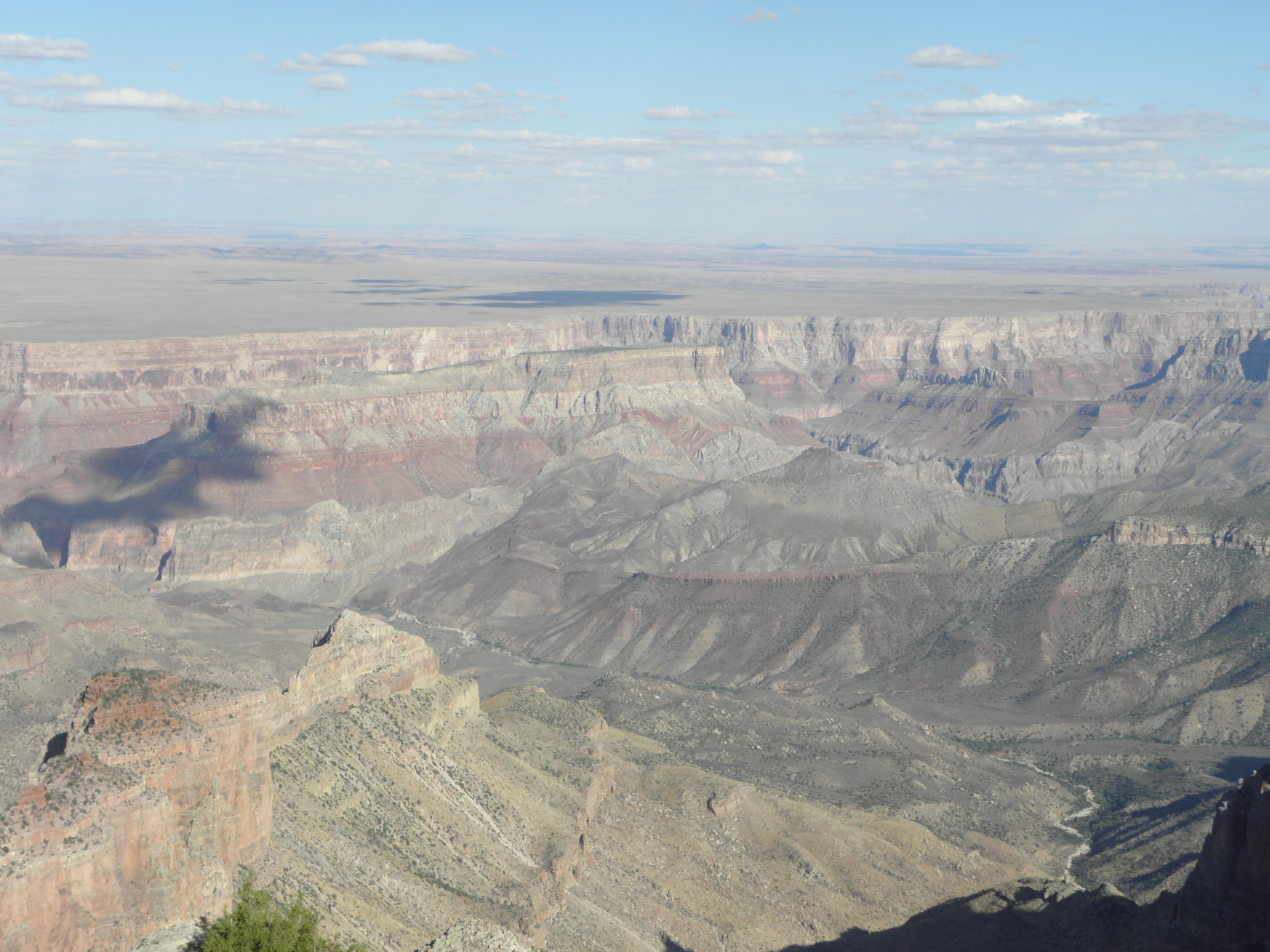 |
| View from Point Imperial, the highest point on either rim |
Tomorrow will likely not contain much in the way of excitement so to tide you over, here are some Vermilion Cliffs:


No comments:
Post a Comment
O hai, spammers!
All comments are moderated so don't bother.
Kthxbai!