Good, innit?
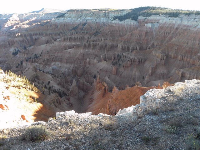
Down the hill again to Panguitch before leaving all the tourist traffic heading for Bryce Canyon behind as UT-12 goes completely bonkers. At one point it runs along a ridge scarcely any wider than the road itself, but you'll have to take my word for this as there's nowhere to stop. Onto UT-24 through Capitol Reef National Park, at which point the motor-car starts pleading with me to check its oil level. Great, you mechanical bozo, why couldn't you do this when I wasn't forty miles from the nearest "gas" station, eh? Common sense wins over thrashing it until it melts before phoning Hertz in accusatory tones, and at Hanksville the level is checked, and found wanting. Hanksville consists of four "gas" stations and a motel, so at least oil is available; the V8 Noise Machine swallows half a US gallon and pronounces itself satiated.
Right here onto UT-95 and a first encounter with the Mighty Colorado River. Or rather a River which was Mighty before the White Man came along and, er, stop me if you've heard this one before. This bit of no-longer-mighty river is named, without a hint of irony, Lake Powell, after John Wesley

The light grey bit in the middle is a boat launching ramp, so that's OK then.
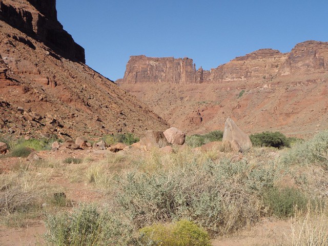
Then left up US-191 to Moab. The White Man has not buggered the river up here, which makes for a nice change. And the town centre looks quite pleasant, even if the outskirts consist mainly of motels, "gas" stations and mountain bike hire shops.
Helpful advices: if you are heading north from Moab with a view to taking I-70 to the east, ignore the TwatNav, as it will try to send you up US-191. Instead turn right onto UT-128, avoid the cyclists and prepare to have your mind melted by the narrow red rock canyon through which the road and the Mighty Colorado pass.
This is one of the less spectacular bits. Finally the road swings away from the river and instead of rocks you get the sort of high plains scrubby grass prairie type stuff which runs north all the way to Montana and quite possibly parts beyond. Seventy millions years ago this area was popular with dinosaurs; today it is mainly full of GBFO Kenworth rigs doing 80 mph uphill. A few miles along I-70 brings one back in contact with the Mighty Colorado, and thus to Grand Junction, which has a population of 53,662 and was the childhood home of the improbable sounding Dalton Trumbo, the Hollywood scriptwriter and alleged ComSymp.
I'm still operating on Pacific time, so it's an hour later than my watch says.
(Heads for fridge for further helping of Sam Adams)
Curious thing seen on the road: dead skunks. Lots of dead skunks.


No comments:
Post a Comment
O hai, spammers!
All comments are moderated so don't bother.
Kthxbai!