Sunday, 28 September 2014

Day 36: Walsenburg, CO - Fort Larrington

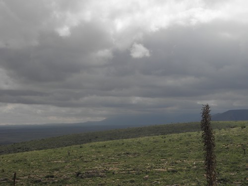
The Mudstang does not have to go back for cleaning and servicing until five o'clock Friday so what, apart from finish packing and have breakfast, to do today?  The direct route up I-25 to the airport is but two and a half hours and 175 miles away, which would make for a rather short and unexciting day.

So I retraced Thursday afternoon's excursion as far as Florence before turning and left and aiming for the gap between Pueblo and Cañon City before striking north-east for Colorado Springs.  The latter brings traffic jams of the type induced by something other than roadworks, railroad crossings (they tend not to be very "level" in this part of the world) and, off to the left, Cheyenne Mountain, under which is the US Air Force's premier-league SEEKRIT Bunker.  Although it's not actually used any more chiz.


The only other thing worth seeing around hereis Pike's Peak, named for one Lt. Zebulon Pike who passed this way an hour ago with his friend, a jealous monk some time in the nineteenth century - he was also the first to explore the Royal Gorge.  He did not, however, scale the mountain which now bears him name, proclaiming any ascent to be totally impossible.  Looking at it from the lower slopes, you can sort of see his point.
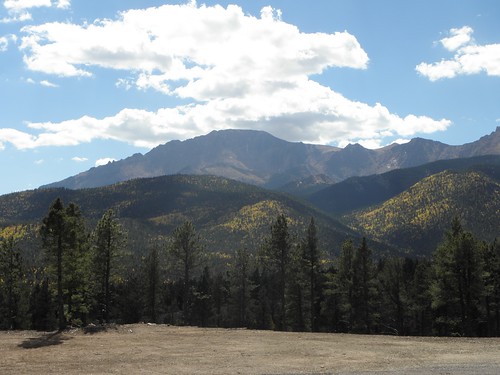
Yes, up there...
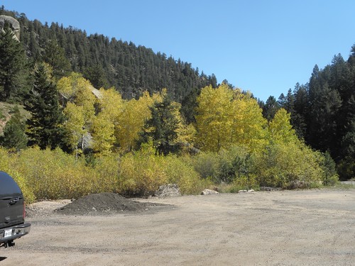
Autumn is on its way to this past of USAnia; previous visits to Pike's Peak have been a couple of weeks earlier.
Trees.  America.  Friday.
Halfway up the mountain and the fuel warning light comes on, indicating an estimated fifty miles of motor-spirit left in the tanks.  Plenty, I think, ten miles up and twenty-five back down to Manitou Springs.  Or is it?  OR IS IT??
Plan on at least half a tank of fuel.  The trip to the summit and back is 38 miles and uses 80 miles of fuel.
Thus spake the leaflet handed out at the tollbooth.  'tis a pity I didn't read this until I reached the airport.  Still, it's downhill all the way from the top, innit (said he, stating the bleedin' obvious)?  And it's too late to turn back now.  At the top is this:
You can't get a Mudstang higher at this time of year unless you drop it out of a C-130
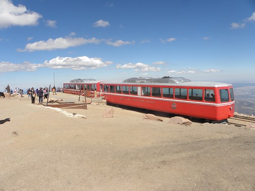
And this:
The train now standing at platform, er, one...
Smart people come up by train and then cycle down.  Also at the summit was Greg.  Greg had been hiking up with his friend/boss when his knee went "SPANG" at 13,000 feet.  The train was fully-booked so he was attempting to scrounge a lift back down.  I'd have given him a lift anyway but the offer of twenty bucks clinched the deal.  A short period of photography and then down, with one eye on the motor-spirit readout.  Greg was excellent company - he lives in Colorado Springs, is originally from Connecticut and had lived for a while near Bristol - and we chatted about cabbages and rhinoceroses in the kitchen nothing of much significance all the way down, having passed the brake temperature check with flying colours.  If your front brakes register more then 300° F on the ranger's Gadget you are sent to the Sin Bin, which fate befell the Ultimate Driving Machine in front of us.  Mine were but 238°.  Hurrah!

I dropped Greg at the bottom and set forth for Manitou Springs.  It's still downhill all the way, leading to coasting down the 45 mph-limited twiddly bits of US-24 at up to 65 before pulling off into town, with the dash having been stating "0 miles to empty" for the last few minutes.  Manitou Springs is another tourist trap, the speed limit in town is 20 mph and parking is at a premium.  Throw in the odd unfamiliar roundabout, a visitor from Florida looking for somewhere to stop and the "gas" station Emily assured me was just THERE on the left being nothing of the sort, it was snacking on the fingernails all round until mercifully another source of motor-spirit popped up on the right.  Fifty dollars will not only see me back to Denver but with luck might fool Mr Budget into thinking the tank is still full.

It was at about dollar forty-seven when the peace was interrupted by a car horn, followed in short order by a loud bang.  Small car turning into "gas" station halts behind stationary pickup.  Which begins to reverse, for no readily-apparent reason.  Much sounding of Audible Warning Of Approach before the inevitable.  The pickup driver is blaming the car driver, President Obambi, ISIS and Slenderman as it was clearly Not His Fault.  They are still going at it hammer and tongs when I leave; it is not beyond the bounds of possibility that at least one driver is armed.  The bloke behind the counter is definitely armed, being a full-on Sikh with a magnificent beard, turban and doubtless the other accoutrements that go with his religion.

Eighty miles to the airport.  Traffic.  Idiots.  Yes, you in the BIGI and your ridiculous lane-changing manoeuvres!  I get the Mudstang home with twenty minutes in hand.  The Budget Bloke, who looks alarmingly like The X-Files' Bill Scully USN, merely reads the Dutch graffiti and smiles.  A bit.

The plane will be late, because they have had to change it for another one.  My seat has changed too.  Things to do in Denver when you're not quite dead: watch my fellow passengers crowd around the gate thirty minutes before they even start boarding, which is done strictly in order of Wealth, Children and proximity to the back of the aircraft.  Thereby gaining the sheeple naught but sore feet.

I do not have seat 16K, but I do have seat 37B, which is next to an over-wing emergency exit and thus affords five feet of legroom and occasional squashed ankles when the cabin crew use it as a passing place for laden trolleys.  London is still where I left it though there is uncertainty as to whether the driver knows this; he certainly has to think a while before he can remember that we have come from Denver.  Yet again no HMRC people on the way out; I rue the missed opportunity to smuggle in a million fags at Colorado prices.

Escape the building for a fag of my very own, while watching three Goons in a Fountain - in this case riding Bromptons up and down the water feature between T5 arrivals and the bus stops.  They are joined by a grinning paramedic on a mountain bike.  Walk the length of T5 looking for the National Express ticket office.  Walk the length of T5 again after discovering it's ten yards from where I exited Customs.  Bah!  M25, Woking station, taxi.  There is a lot more legroom in the back of a Merc E-Class than in Sergeant Aten's Crown Vic.

I'll leave it there for this year coz no-one wants to hear about the M25, Sainsbury's in Walthamstow Avenue or junk mail requiring a SHUVEL to clear before I can open the front door of Larrington Towers.  A big thank-you to Clair Walters for the travel mug, wot was ded useful

  1. Lie
Friday, 26 September 2014

Day 35: Walsenburg, CO

If you find this entry a little tardy, dear Reader, it is because I have been poised over the Online Check-In doobrie on BA's webby SCIENCE until the clock spiralled down to zero, that I might avail myself of the option to change seats with the driver.  Or something.  And then it turns out I have been allotted seat 16K anyway, which is the window seat right at the front of the cattle class cabin and thus has adequate space for my knees.  Hurrah!
The Mudstang now says "Oil change required".  It still seems to have an adequate quantity of the stuff, though, so it can go home in that state.  Sorry, Mr Budget.  This afternoon a Yoof in a passing motorcar in Cañon City stuck his head out of the window, exclaimed "Mudstang! Cool!" and made that gesture with his index and little fingers so beloved of the late Ronnie James Dio.  So let's have a bit more rispek in future.  Innit.

Just because I am spending two nights in the same place does not mean I have been idle, no.  I have still driven quite a long way, only without a rucksack on the passenger seat or The Luggage wearing out the rear shock absorbers.  A few quick miles up I-25 and then off into the woods and lumps of the San Isabel National Forest.  I could have reached my destination rather more quickly on I-25 but it runs along the bottom of the Front Range - the bit of the Rockies immediately west of the Several of hundreds of miles of flat bit between here and the Mighty Mississippi - which is dulk.  The San Isabel region is not.
Lake?  Trees?  Mountain(s)?  Sorted...
At which point the Mudstang started to complain of thirst and Emily said the nearest "gas" station was in Pueblo.  Fortunately she was right, as I reached the pump with the readout claiming four miles to empty.  We know how (in)accurate said readout is, but it's still a tad uncomfortable.

West from Pueblo along our old chum US-50, which is emphatically not lonely in this part of the world.  Up the hill after Cañon City and turn left onto a very wiggly back road, which leads to this:
BRIDGE!!!1!!
Doesn't look like much from this angle, I'll admit, but then the above is not its best side, dahling.  No, to get the full experience you have to cross it, walk up the road a bit and turn round.
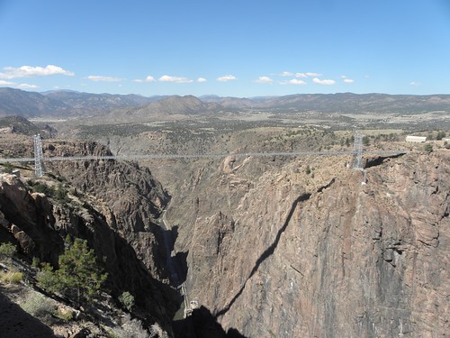
BRIDGE!!!1!!
This is the Royal Gorge Bridge, built by a madman in 1929.  Using your Junior Pocket microscope (model 3a) - or by nipping over to the Flickr Stuffs for bigger images - you may be able to see the Arkansas River at the bottom of the hole.  It is either 955 feet (291 m) or 1053 feet (321 m) from the bridge deck to the river and it is a Deeply Scary Thing to anyone at all nervous about heights.  Like, for e.g., Mr Larrington.  This bridge is worse than most because it is small compared with the likes of the Severn or Humber bridges and because you can feel it moving in even the gentle breezes wot there were this afternoon and because it makes disconcerting noises and because the bridge deck is apparently made of fucking railway sleepers1 and you can see through the gaps between them a thousand feet straight down and I actually paid good USAnian money for the privet hedge of walking across this antique and ["Nobody forced you to do it, idiot!" - Ed.]

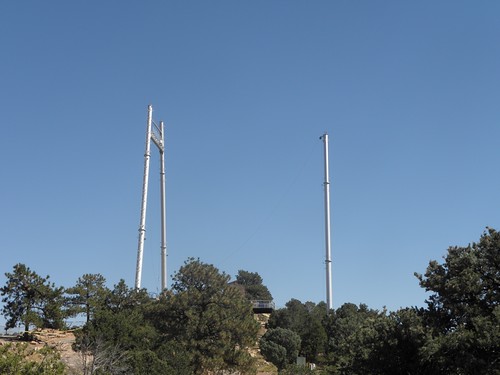
On the other side of the bridge is this:
An Infernal Device, yesterday
I did not wish to contemplate too closely its purpose, but found out anyway.
What?  The?  Fuck?
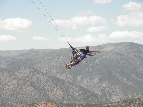
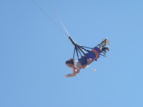
This is the Royal Rush Skycoaster® and you have to pay extra to have a go.  On it.  I would say that these people are so mad that they have mad people living in their beards, but then these two rocked up up:
The lady in the blue dress is eighty; that is her thirty-one year old grand-daughter in the white blouse.  Neither of them screamed either.

All this was bad for my heart rate, blood pressure and general mental well-being, so I went back to Pueblo in search of something which didn't move when you looked at it:
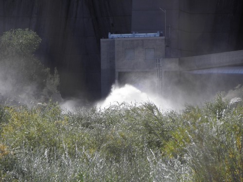
The Arkansas River emerging from the base of the Pueblo Dam.  No, it's meant to!
Thus reassured as to the relative stability of the universe, I took a roundabout route back to Walsenburg involving more mountains and very little traffic.
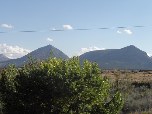
The last of the mountains?
And then back to the Babbage-Engine waiting for BA to get its act together.  Last full day in USAnia.  Sob.

For this year.

  1. Keanus2 anyway.
  2. Keanu = big piece of wood3
  3. Wood is an excellent material for making trees but is otherwise not to be trusted - LJK Setright.

Thursday, 25 September 2014

Day 34: Española, NM - Walsenburg, CO

Just don't stop in Española, keep driving.
Also sprach yacf's Woollypigs at eight this morning in Skipton, or 01:00 in Española.  A bit late, in other words.  Still, it's the thought that counts

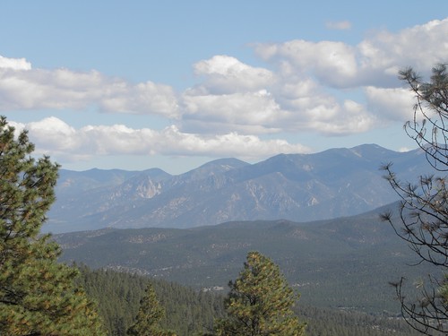
This morning I will hie me to Taos.  Taos is ded gud, apparently, and hav a very interesting history etc. and is full of arty types.  I didn't like it enough to linger for long at all (see also "Aspen") but the drive up from Española was nice, with proper mountains and corners and so forth.  Also I found another phone in a lay-by, but this one didn't work either.  Taos is not actually in the mountains as such, no, it sits on the edge of the Taos Plateau which, as the name suggests, ought by rights to be one of the scorching plains™ of New Mexico.  It's got mountains behind it, though:
As I drove out of town, a beat-up VW microbus was coming the other way while an executive jet roared overhead from the adjacent airport.  This is some kind of powerful metaphor, I think, or a coincidence.  Also Kit Carson (remember him?) is buried here.

Besides, the real reason for going to Taos lies a few miles to the west of the town.  Across the scorching plain™ and up to here:
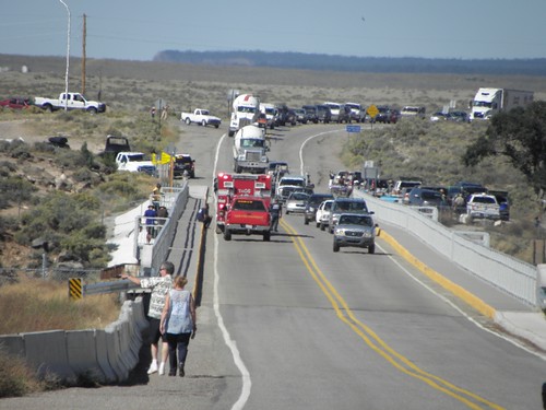
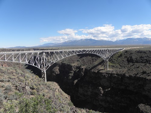
Single-line traffic, the fire department and several different species of small furry animal law enforcement types.  Clearly there'd been an incident of some sort but I didn't like to ask and there's not been anything readily locatable on the Intertubes either.  People are always jumping off it, though, because from the other side it appears thus:
BRIDGE!!!1!!
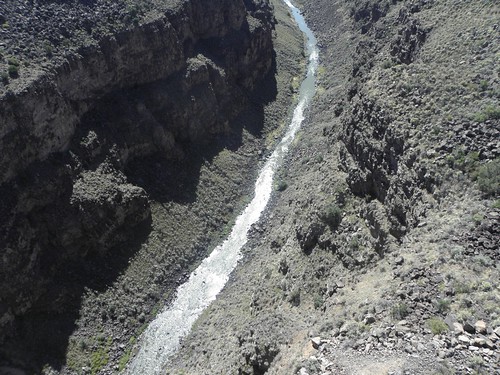
Under this bridge - a long way under it - is the Rio Grande.
...those are far away
Natch the place has attracted a little cluster of people selling handicrafts but because this is Taos, the Native Americans have been joined by Mr Whitey Dreadlocks and his ilk.  I did not investigate their wares.  Carvings of dogs on strings?  I'm a crashing snob, aren't I?

Just around the corner from the bridge is the Earthship Biotecture and then back to more scorching plain™ peppered with shacks, trailers and dead pickup trucks and looking like a right fucking mess.  But finally cometh US-285, on which much time has been spent already lately, so straight across on US-64 and into some more proper mountains.

How proper?  This proper:
This was taken at the lay-by just after the highest point, which Emily reckons to be 3212 metres.  Or 10,538 feet.  This point is not marked on my map and nor does it merit a mention on Wikinaccurate.  And, more to the point, it did not feature in my travels in 2011 either.  Now I'll have to do them all again.  How many other undiscovered ten-thousanders are there lurking in this corner of the Rockies?

I thought I'd found a couple on crossing back into Colorado, but they turned out to be the Cumbres and La Manga passes, which I did visit in 2011.  The road more-or-less follows the route of the Cumbres & Toltec Scenic Railroad, which we encountered in Antonito last week.  Today I could hear the trains but not see them.  In 2011 I did a U-turn at the top of the La Manga, which was a mistake as the descent is triff.
Looking north-ish from somewhere on the La Manga pass
This follows the valley of the unfortunately-anagrammatic Conejos river until it emerges, blinking, from the trees and out into the San Luis valley, which is only prevented from being a scorching plain™ by virtue of being in Colorado and not New Mexico.  Even the trucks can keep up 65 mph across here, but show them the slightest vestige of the La Veta pass and they disappear backwards at a rate of knots.

The La Veta is one of those wide sweeping jobs which are excellent until you reach the summit just too late to overtake a pickup driven by - to judge from the verve and aplomb with which it was being conducted - Miss Marple.  And so to Walsenburg.  I read something about it recently but can't for the life of me remember what.  Or where.  But it's reasonably close to Denver and one or two other things I plan to visit before getting back in the big metal bird to That London, so here I stay for - gasp - two nights.

On the feeding habits of Mudstangs: I did not have to replenish the Mudstang's supply of motor-spirit at all today.  On the other hand, it is asking plaintively for an oil change so I suppose I should check the level tomorrow.

Wednesday, 24 September 2014

Day 33: Socorro, NM - Española, NM

The good news is that I haz teh Intarwebs here.  The bad news is that they are slow.  Slower than the Slow Children, in fact.
Joke shamelessly stolen from Iain Banks
Bah!  Today was supposed to be a mixed bag of scorching plains™ and mountains but the roads across the scorching plains™ always seemed to veer away from the lumpy bits at the last minute to reveal another thirty miles of scorching plains™.  Plus I am beginning to think it's the wrong time of year for the plains to be scorching anyway.  Money back please!

East across the scorching plains™ first, to Carrizozo.  On the way you pass the top end of the White Sands Missile Range - somewhere in this lot:
A SEEKRIT military base, yesterday
is where Dr Oppenheimer and his homies set off the first atomic bomb evvah.  For some reason Mr Obambi doesn't encourage visitors to the site.  Carrizozo apparently has Ancient History, in the form of some connection to Billy the Kid.  Seems he killed one or more people utterly to DETH in these parts.  I have read elsewhere that he was a thoroughly nasty piece of work, shot most of his victims in the back and suffered from syphilis so why he is worthy of celebration is something of a wossname.  No, I think we'll leave Mr the Kid to his own devices today.

Turn north towards Corona.  They are turning this bit of US-54 into a dual carriageway.  16 miles of roadworks pass very slowly at 45 mph, but the trucks on the site have some wik strobe lights, like a Hawkwind gig with a diesel engine.  Corona consists of not a great deal which is why, although considerably nearer to the 1947 crash site, the incident was reported to the La in Roswell.

Turn left here onto NM-42.  The first mile promises much.  Corners!  Hills!  Oh.  It soon turns back into one of those non-scorching plains™ and the smoothest way is to hug the centre line that one will not rock up on the Day of Judgement and hope that TEETH WILL BE PROVIDED!  There, I knew I'd get Ian Paisley into this year's Automatic Diary somewhere.  Eventually you end up here:
And there's more where that came from...
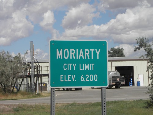
I like to think that this is where  the great French poet and lyric plumber Count Jim "Flies" Moriarty settled after proving to Grytpype-Thynne that he had indeed made enough saxophones to sell to the Indians.  Anything to get out of that retired wooden fish crate.

Then Santa Fe, where all the "gas" stations are on the opposite side of the road.  I must have passed the Wol Liquor Store three times before finding one which wasn't disguised as a branch of Burger King.

Where to stop for the night?  Taos is too far, plus it's bound to be a tourist trap (see also: Moab, Carlsbad, large chunks of Colorado, etc.).  Aha!  Los Alamos!

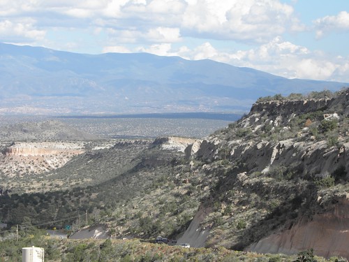
The road up to Los Alamos provides much in the way of scenery.
The view from the road both to and from Los Alamos
And so does the road down, which is the same road.  Because Los Alamos is full.  Last time I was here, in 2005, it was shut.  I sense a conspiracy.  Helpful Zack at the Holibob Inn suggested one of the casinos back down the hill; I think these are part of the revenge of the Native Americans for lies, genocide, smallpox and saxophones.  I am not a gambling man so instead fetched up at Española.

Not the most inspiring day, all told, but at least teh Intarwebs seems to have woken up a bit.

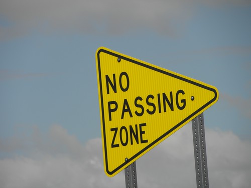
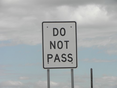
On scrap metal dealing: In New Mexico there are two sorts of single carriageway roads, viz. those that traverse the scorching plains™ and those in the mountains.  The latter have blind corners and frequent changes of gradient while the former lack the twisty bits but have plenty of dips and crests to trap the unwary, fill with flood water and provide cover for Billy the Kid.  Thus both have frequent "no passing" zones.  At the start of each and every such zone there is, on the left of the road, one of these:
while on the right there is one of these:
And at the end of the zone, one of these:
These three, by the way, were no more than a hundred yards apart.  The signs are quite large and made from aluminium.  We have similarly-constructed signs to mark off the distances at Battle Mountain; had they not fallen off the back of Don Schroeder's then-employer we'd have had to stick with the ancient home-brewed wooden ones which never quite recovered from spending a Several of months in a shipping container half-full of snow-melt.  Anyway, there must be untold thousands of these signs in New Mexico.

You can guess the rest.  It's probably safer than nicking railway signalling cables, anyway.

Tuesday, 23 September 2014

Day 32: Las Cruces, NM - Socorro, NM

Let's start at the end, said Alice.  Socorro may have its good points but the access to teh Intarwebs at this place is not one of them.  It doesn't work.  Arses.  So if you are on tenterhooks awaiting this instalment of the Automatic Diary, that is why.  And if you are trying to sell me Burial Insurance, or your name is Natalia and you'd really like to meet me, or you're trying to scam me out of my e-mail login details, just fuck off.

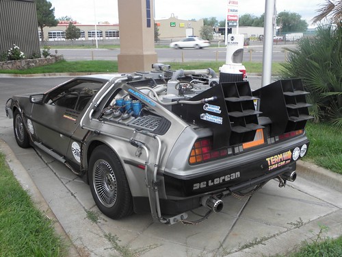
Rewind.  You may recall the instalment of the 2012 Automatic Diary that started in Amarillo, Texas and visited the Cadillac Ranch.  Where I met Oliver and Terry Holler and their DeLorean:
At the Cadillac Ranch, September 2012
Outside the motel in Las Cruces this morning was this:
One-point-twenny-one Gigawatts?
Which is different.  Being unable to get to Teh Intarwebs I am unable to divine their purpose, but if you, dear Reader, are reading this then I will have had access to teh Intarwebs and hence, oh, never mind.  You could work in a time travel paradox gag there if you felt like it.  There was also this:
Ugh!
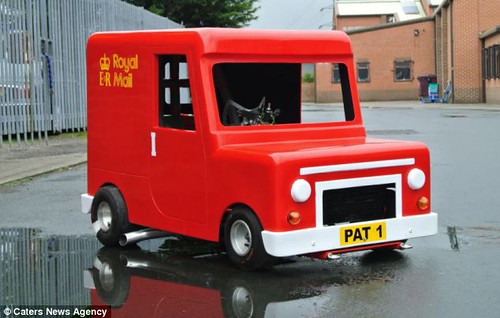
This is a Scion XB.  Scion is Toyota's Yoof Brand over here and this vehicle was designed by the same pre-teen child who also did the Honda Element, the Nissan Cube, the Kia Soul and Postman Pat's van.
See?
I cannot take issue with the "Flying Toaster" sticker but to proclaim it "filthiest" while in the same car park as the Mudstang displays a massive cheek.  Unless it refers to the owners' dogging habits.  Look it up.

Back onto I-10 westwards across the scorching plains™ of New Mexico, where it was raining and the surface was crap.  Where are you heading today, asked Agent Lopez of the Border Patrol at yet another checkpoint.  When I answered Socorro, instead of taking one step backwards as one might when in the presence of Madness, he takes one step forwards, because he is equipped with a .357 Mortalitastic Kill-o-Matic.  Sensible people travelling from Las Cruces to Socorro, you see, go straight up I-25 northwards.  It is shorter.  I explained about my quest for Mountains; he allowed as how it was real nice up there and wished me a pleasant day.  Sir.  You can afford to be polite with that kind of firepower.  The road atlas marks what M. Bibendum thinks are "scenic" roads with little green squares and sometimes the fat rubbery fellow is right, but the scorching plains™ of New Mexico are never going to be "scenic" even when they actually are scorching.

Leave the freeway at Deming and head northeast across the scorching plains™ of New Mexico, where it was no longer raining and almost warm.  Nine or a dozen classic Airstream trailers (caravans to you and me) going the other way.  At Silver City I ask Emily to find the nearest "gas" station as I have overshot and don't think I have enough to get to the next dot on the map.

She directs me to the cemetery.

After Silver City it gets nicer as the scorching plains™ of New Mexico are left behind in favour of the Mogollon Mountains and the Gila National Forest.  The Gila River may be found in these parts too and as I've just recrossed the Continental Divide - last seen atop Wolf Creek Pass and previously at Milner Pass in RoMo NP and La Poudre Pass in the rain what feels like an age ago - it is, natch, a tributary of the Mighty Colorado.    It's supposed to reach the latter near Yuma but as it has to pass very close to Phoenix to get there, I rather suspect that it doesn't, if you see what I mean.

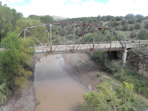
Also up here are the mortal remains of a narrow-gauge railway - the occasional suspicious-looking embankment is still in evidence, as is this bridge:
BRIDGE!!!1!
I suspect the pair on a tandem might have wished they'd turned the track bed into a rails-to-trails path instead of leaving it to rot.  Somewhere near the improbable-sounding town of Reserve (and improbable is highly possible in New Mexico - only sixty-odd miles south of here is the town of Truth Or Consequences!) is this:
I have my suspicions, but can't help but think it's a long way to come to hide the body of Dark Side legend Steve Slade.  There may be as many as three of you who will understand that joke.  Clarion on yacf has just pointed out that it could refer to that bloke who used to be in Guns'n'Roses.  Pshaw!

Back over the Continental Divide for (probably) the last time and turn right onto US-60.  It occurs to me that I have been here before, on the first full day of the 2005 trip, the memory being triggered by the sight of this:
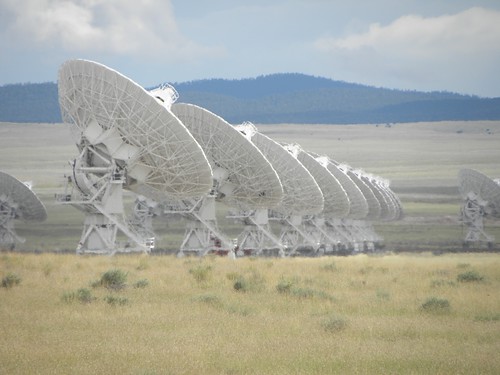
Jodie Foster was out...
It is not used for SETI, in spite of what the late Carl Sagan tried to have us believe in "Contact".  Which was only redeemed from Total Crapness because it has Jodie Foster.  In it.  Also they CGI'ed more telescopes into the film, as if 27 weren't enough.  The VLA is situated on the scorching plains™ of San Agustin whom I suspect is not the same chap who did all that stuff in Canterbury translated into Spaignish.

Finally a long descent into Socorro, on which it was raining.  I managed to make it to the motel without having to stop for the roof, fortunately, as I'd just spent five miles waiting to overtake that livestock trailer.  And for the second successive day I have a chair which sinks slowly groundward as I type.  Outside there is a wik thunderstorm but teh Intarwebs was DED long before it arrived.

Additional: if you use iTunes, be advised that you are not going mad.  No, The Mega-Global Fruit Corporation of Cupertino, USAnia, has really added U2's "Songs Of Innocence" album to your iTunes library without even asking, the cheeky fuckers.  But when I wanted them to sell me a download copy of Samson's debut album "Survivors" they couldn't because it's not currently available in BRITAIN.  Gits.

On DJ Random having a Bad Day: I know it is partially my fault for having six versions of Jimi Hendrix' take on "Hear My Train A-Comin'" on my iPod, but I do think DJ Random was being a bit silly to play three of them on the same day.

Monday, 22 September 2014

Day 31: Alpine, TX - Las Cruces, NM

Alpine, as any fule probably does not kno, is home to vast numbers of small snails which emerge after dark and get trodden on when you go outside for a smoke.  This is Not Nice.  I'd rather the taranshulas.  On the other hand, there is an RV park on the outskirts of town called the "Lost Alaskan".  Which is nice.

Today was a short one in terms of time at least, as I spent longer on the Interstate Highway system than any other day so far this year.  Kent to El Paso and then a further chunk from El Paso to Las Cruces.  The off-piste detour was to visit Target in Far East El Paso (sic).  Emily found it in spite of the extensive road-building going on thereabouts - there are so many half-completed flyovers that I expected to see a bus driven by Keanu Reeves on one.  Of them.

Target did not have small kettles.  Bah!  Someone had suggested REI, but Emily has never heard of them and a subsequent application of a Famous Web Search Engine shews that the nearest branch is in Albuquerque.  Two hundred and thirty miles away.  I will have to improvise my Proper Tea for the rest of the trip, I think.

The first leg of today takes one through the Davis Mountains, which were discovered by my industrious brother-in-law1 some twenty years ago.  These are nice to look at even though it was threatening to rain on them.
A Davis Mountain, yesterday
Mitre Peak looks like the result of giving a small child a crayon and asking them to draw a mountain:
Sorry about the murky weather.  I didn't order it.
Another one has McDonald Observatory on top of it:
That's every photo I took today, due to being mostly on I-10 and being disinclined to stop for Puma concolor a.k.a. the cougar, mountain lion or panther I saw near Kent, not least because it was very dead chiz.

I don't know what it is about I-10 that causes it to eat truck tyres - I observed the same phenomenon from Florida to Louisiana two years ago.  Surely not just because it's hot, otherwise Arizona would be invisible beneath a mountain of time-expired rubber.

I-10 in Texas is notable also for the number of sets of skid-marks leading off straight bits of the carriageway into either the median strip or the undergrowth on the right.  Colour me baffled.  The El Paso ring road has a terrific bit over the mountains, though, which is a bit like a 2/3 scale model of I-80 east of Salt Lake City.  And just over there / are some wik mountains which I'd take a picture of if it was light, but it isn't as I'm back in the Mountain time zone now. That is enough time zones for this trip i.e. I'm not going back into Arizona with its unorthodox approach to Daylight Saving.  I imagine the daylight they do get during the summer is more than adequate in both duration and temperature.  Though on the day I arrived in USAnia Phoenix received six inches of rain, which made me rather glad I decided on Denver.

DJ Random was uncommonly keen on Muse today.

  1. He also runs John Davis Trucking in Battle Mountain2.
  2. Lie.

Sunday, 21 September 2014

Day 30: Del Rio, TX - Alpine, TX

Alpine, I thought, what a damn' stupid name for a place in Texas which will doubtless be surrounded on all sides by MMFD.  Just goes to show how stupid I can be as Alpine is indeed somewhat alpine in surroundings, and about the same height above sea level as Battle Mountain or the summit of Ben Nevis.  I didn't know they even had mountains in Texas before today, but there are some quite tasty ones to be had, albeit not Rocky or Sierra-sized ones.
A Texan mountain, yesterday
First the bad news.  Wol-Mart in Del Rio does not sell ickle travel kettles and as mine died on its arse last night I am having to improvise Proper Tea using the In-Room Brown Drink Making Facilities.  It works surprisingly well.  I have been advised to try Target instead of Asda West (thanks, TimC, for both the advice and the name!), but the nearest one is in El Paso which is supposed to be under a Several of feet of water.

Yes, west Texas was scheduled for a repeat dose of Tail-End of Hurricane Odile, the storm which caused all yesterday's shenanigans.  And it certainly looked pretty gloomy when I emerged kettleless from Wol-Mart this morning but after a few drops it stayed fine around me until mid-afternoon.

The first part of today's route read "Retrace to Sanderson; SO $ Marathon", or it would if I was using an Audax route sheet instead of Emily.  Added excitement came from the peculiar mechanical rattling coming from Somewhere on the right front of the Mudstang at speeds above 65 mph.  I even opened the "hood" to look for stray mariachi musicians, but found only a loose rubbery doofer no longer covering the positive terminal of the battery.  Worrying rattling sounds can best be dealt with by:

  • Cranking up the stereo, or
  • Lowering the roof, or
  • Both

Worked for me...  More motor-spirit in Sanderson where, praise be, the "gas" pump didn't do any of that tedious mucking about with "ZIP codes".  Only the fourth one this year.  IIRC the USANians were supposed to be introducing Chip & PIN back in 2009/10, so it is a mystery why it has taken them so long to introduce a different, and brain-damaged, system instead.

After Sanderson come the mountains which I didn't know were there, and at Marathon 'tis "L US-385 $ Big Bend National Park".  Big Bend National Park is low on the list of Famous National Parks headed by Yellowstone, Yosemite, Zion etc.  Possibly because to get there you have to get to either Marathon or Alpine, which are both pretty remote, and then drive a further seventy miles into the back of beyond just to make it to the entrance.  Where you may well get the next best thing to a guided tour from Ranger Jack at the Persimmon Gap Visitor Center.  I'd fancied visiting here ever since reading of someone's early morning experience of finding scores of tarantulas basking on the roads.  I didn't see any taranshulas myself, which is no bad thing as I'm not keen on them, but thanks to Mal Volio for the tip.

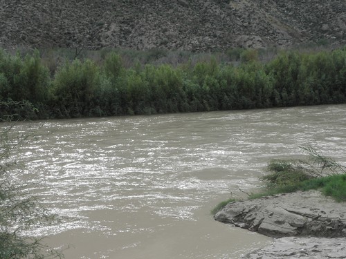
Big Bend is so named for the Big Bend that the Rio [Grande|Bravo del Norte] makes around the mountains.  It must have taken them minutes to come up with that one.  The river hereabouts is no wider than it is in Alamosa but is running rather quickly and I for one should not be tempted to swim across it.  And not just because of the presence of Border Patrol agents pretending to be birdwatchers either.
The Rio Grande.  In the background: Mexico.  In the foreground a special treat for ZZ Top fans: Rio Grande Mud.
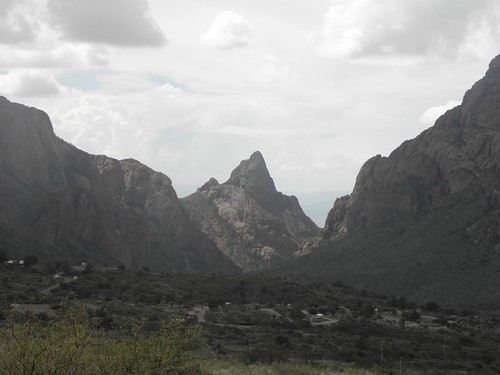
Smack in the middle of the park is the extraordinary Chisos Basin, being a cirque surrounded almost entirely by high mountains with a titchy outlet to the rest of the world called The Window.  You can walk to the window from the Visitor Center, but I don't do walking in that sort of rain, thank you.  It had arrived, you see, a Several of hours behind schedule but fairly intense.
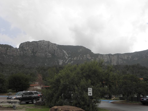
Back wall of the Chisos Basin.  Here be mountain lions.  And BEARs.
There exists a short-cut back from Santa Elena Canyon on a dirt road but the rotters had closed it.  Probably sensibly given the state of the weather, though it had occurred to me that one way to conceal the Team Cygnus graffiti would be to apply a fresh layer of mud to the Mudstang's flanks.
Mexican cliffs at Santa Elena Canyon
Most main roads within a three-day swim from the Texas border day's march of the Tortilla Curtain are heaving with Border Patrol agents.  They also have permanent checkpoints where they stick the barrel of an M-16 up your nose while barking demands for your papers.  Actually they don't; they are scrupulously polite and one of them was even a West Ham fan.  Srsly.

Alpine, as I have noted, is a nice enough place but they haven't wasted much cash on fripperies such as street lighting.  Which is why, as a result of Unanticipated Puddle Discovery during tonight's Milk Run, I shall need to wash my feet before going to bed.

On DJ Random sometimes getting it right: DJ Random is a so-called "Smart" Playlist who lives in my iPod and plays tracks at random provided their current play count is 0.  I think he may be suffering from Droid Rot as he's definitely served up HMHB's Eno Collaboration twice so far.  However it was pleasing that in the middle of the National Park he played Olé! Tarantula by Robyn Hitchcock & The Venus 3, not to mention something by Rodrigo y Gabriela a literal stone's throw from Mexico.  The icing on today's cake, though, had to have been Tom Lehrer's Oedipus Rex followed immediately by Amplifier's Number One Son.

Saturday, 20 September 2014

Day 29: Carlsbad, NM - Del Rio, TX

Good choice by DJ Random: Somewhere In Texas ~ The Raveonettes
Bad choice by DJ Random: Feel Good Hit Of The Summer ~ Queens Of The Stone Age

It rained last night, y'see.  Apparently the area is on the receiving end of the remnants of a tropical storm which has wandered further inland than is seemly.  Or maybe it was a Pacific hurricane.  No matter, it started doing Big Rains at about 19:00 last night and was still doing so when I left Carlsbad at 07:30 this morning.  A rain almost as long as that of Queen Victoria ha ha.  In spite of this dousing, the driving through the stuff, the periodic negotiation of flooded roads and the jet-wash from passing trucks, the Mudstang remains resolutely filthy.  I can read the rear bumper from here and that's with my reading glasses on.  I may have to visit a car wash next week chiz.

US-285 south of Carlsbad is vile - narrow, bumpy and blessed with a high number of idiots driving in the foulest weather imaginable without lights on.  Overtaking is therefore impossible.  US-285 immediately after the Texas state line is similar, but with one important difference.

It is closed.

Either the news hadn't percolated into New Mexico or it had and the latter had decided that what happens in Texas is Someone Else's Problem.  At any rate, a large man in waterproofs designed to make him resemble a psychedelic fridge-freezer informed me that I needed to go east first to get to I-20.  I didn't much want to get to I-20 save that I had to cross it to get further south, but told Emily where to take me.

Even an Emily fully-educated in current road locations wouldn't be able to tell me where the rivers ran, but in spite of hopping around the local equivalent of "B" roads there was only one stretch which caused any concern.  Rule of thumb: if you can still see the centre line through the water you will not have any problems provided you slow down.  If you do not slow down you will go sideways, and crash.  This is a Bad Thing.

When I got back into Texas it was much the same only with higher speed limits. The towns are susceptible to standing water.  I had to refill the Mudstang in Monahans; the water around the "gas" station was deep enow to cause concern even to yahoos in duallies1, who normally drive over anything in their path.

It finally got better after Fort Stockton, which is inhabited by some of the worst drivers in USAnia.  The sun came out and the Stockton Plateau provided Scenery.  Not brilliant - on a par with some of the less interesting parts of Utah - but scenery nevertheless.  There were even corners of a sort, though I haven't actually had to brake for one since leaving the wiggly bits at the foot of Wolf Creek Pass.  Including the 90-right in the Alamosa one-way system.
Hills.  And a corner.  Wowsa!
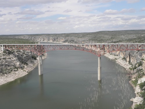
I put the roof down when the above was taken too! Once you hit US-90 in Sanderson things get a little less interesting, but there is some Top Bridge Action to be had.
US-90 over Pecos River, near Comstock, TX
Also of interest is the well-graded dirt track running parallel to the road on its southern side.  It puzzled me for a bit, but it's there to allow the Border Patrol to trundle along at low speeds looking for Norty Mexicans without inconveniencing other traffic.  Mexico is only a couple of miles away across the Rio Grande (aka the Rio Bravo del Norte to those who speak Spaignish) but the nearest border crossing is about fifteen miles back up US-90.

So I'm in Del Rio as it was the nearest spot on the map "near" Big Bend National Park that looked likely to support civilisation.  The detour added a hundred miles and crossing into the Central time zone has cost an hour, so it is already dinner-time.  In retrospect it would have been far more sensible to spend two nights in Alpine but I didn't know whether my reservation for Del Rio had gone through due to the wonky Intarwebs in Carlsbad.

As an aside, I have had more issues with teh Intarwebs on this trip than any other two combined.  Last night it was fine up until shortly after I'd posted the Automatic Diary entry, after which it was up and down like a bipolar jack-in-the-box.  That in the Super 8 in Battle Mountain may have been a bit slow, possibly due to a preponderance of techno-weenies all uploading photos and blogging away like Trojans, but at least the thing stayed up.  I can only conclude that water got into the pipes yesterday and washed the Magic Smoke away, as Mine Host couldn't give me a receipt this morning, as it was still down.  Now watch him charge me for three extra nights while I'm three hundred miles away.

On liking X with that: You may, Constant Reader, be aware of the old piece of wisdom poetry concerning tomato sauce viz. When you shake the ketchup bottle / None'll come and then the lot'll.  You can therefore probably guess what happened when I was spicing up my dinner with a little extra ground chili tonight.

  1. A "dually" is a GBFO pickup truck fitted with two wheels at each end of the rear axle and, usually, with the noisiest V8 local arms limitation treaties will allow.

Friday, 19 September 2014

Day 28: Roswell, NM - Carlsbad, NM

A day short on distance but long on Kulture.  I only did about the distance from London to Birmingham and only that much because Carlsbad Caverns are a fair way from the town city of Carlsbad.  Which, doubtless due to its proximity to said Big Holes in the Ground, has some of the most ludicrously overpriced accommodation I've yet to find on this trip. Or, indeed, any other.

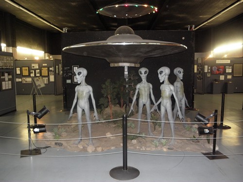
First port of call was the International UFO Museum And Research Center in Roswell.  I ponied up my five bucks in anticipation of a cheap morning looking at tqt1 and then spent twenty-two on a T-shaped shirt.  Pshaw and, moreover, fiddlesticks.  Some highlights:
Mayan camera bike, c. 683 AD.  Derek von Heineken has his own theories about this, but they're a Rubbish...
Some aliens, looking for the Gents.  They do actually have arses!
Woman looking for the form guide for Newton Abbot
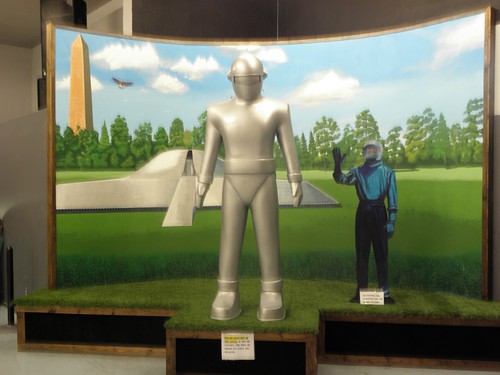
Klaatu is unable to work out why he's having trouble hailing a taxi
Anyway, here is what I have managed to deduce about the "Roswell UFO Incident".
  • No two "experts" can agree on what, if anything, was involved.
  • No two "experts" can agree on where anything took place.  If it did.
  • No two "experts" can agree on when anything happened either.  "Summer 1947" is a bit vague.
  • No single "expert", or team of "experts", has the faintest idea of how to design a legible web site.
  • The "experts" are, by and large, totally Hornchurch2 sorts who think The Illuminatus Trilogy is a true story and/or that The X-Files was a documentary3.
Fortunately we at the Ministry of Lies and Filth have a contact who knows someone who knows someone else who was actually there.  He consented to talk to us, and spake, and said:
Borag Thungg, Earthlets!
Here's the Truth (which is, of course, out there):
  • Something SEEKRIT, but not very scrotnig, crashed
  • Or possibly more than one Something SEEKRIT but not very scrotnig
  • The US Army didn't want the Soviet On!on to find out about it
  • The US Army organised a cover-up, which is not unheard of
  • But they didn't do a very good job of it, which is also not unheard of, the great grexnixen
  • Some thrill suckers told lies in a quest for fifteen minutes of fame
  • There were no alien bodies
  • There are no black helicopters either
  • David Cameron is not a lizard
Splundig Vur Thrigg
Tharg the Mighty, Quaxxann (near Betelgeuse)
["Are you sure we can trust this bloke?" - Ed.]

No mention of The X-Files chiz so I cranked up the Mudstang and wandered lonely as a person sharing a State Highway with a few other people down to Carlsbad Caverns.  These hav a very interesting history if you are interested in hist. which few boys are.  The main cave is home to a myriad of bats, who come out at night to hunt insects; this being how it was discovered in 1898 by lonesome cowboy Jim White.  Obviously the Native Americans had been aware of the place since forever but they never bothered to tell anyone.

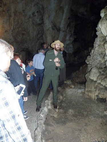
You can get in via the "Natural Entrance" and the Batcave (srsly) but that involves more walking than my feetses care to do these days, especially with it threatening to chuck down.  Alternatively you can go down in the lift, from the bottom of which I joined up with the guided tour of the King's Palace, ably led by Ranger Jim.
Ranger Jim tries unsuccessfully to get his torch to work
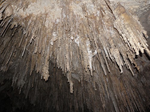
This area of the cave has been guided-tour only since, IIRC, 1992 as pikeys kept breaking bits off the speleotherms (look, I learned a new word!) as souvenirs.  You can also do the Big Room, but as the name suggests, it's Big and takes longer to do than I would have preferred.  Also it's not warm down there.  But it's got some groovy rocks:
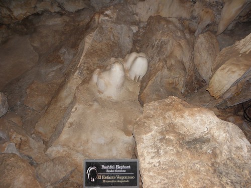
This is supposed to resemble an elephant's bum, but I can't see it myself
I had to swap both the memory card and the flatteries in the camera while down there, which must be some kind of record.  A set of four AA lithiums normally lasts me for an entire USAnian trip; this year they lasted less than a week and I've gone through four sets of boggo Duracells as well.

It wasn't raining when I got out, but this lot was on the horizon
and the bats' agent won't allow them to be photographed when they come out, so I made my excuses and left.  As noted above, Carlsbad is a tourist trap and the place I'm in now is charging about twice the price I paid in Kremmling for a similar level of nastiness.  Anyway, it's time for Proper Tea, so it's a good job I wrote half of this rubbish last night.

On Business Opportunities: On Wednesday morning a chap bearing an uncanny resemblance to my former cow-orker Mr Wyatt strolled up to the motel reception desk and asked if there was a marijuana shop in town.  Colorado, y'see, legalised the sale and use of cannabis sativa on January 1st.  I am given to understand, however, that the sellers are having a hard time investing their not-inconsiderable profits.  The Feds regard such monies as being the proceeds of CRIME and will, I'm told, not allow it to be deposited in any bank ultimately insured by the Feddy-Bears.  Do any Readers know anything about USAnian banking La?
  1. Sheddi abbreviation for "top-quality tqt"
  2. Half a dozen stops beyond Barking
  3. Usual disclaimer about Lie...