Anyway, you won't find any of that metric nonsense over here. The Mudstang's instruments can be switched to metric, I imagine as a sop to those heathen Canadians, but I haven't bothered in case the car dobs me in to Homeland Security. Note to self: do not wear that T-shaped shirt with the picture of Karl Marx on it until you get to Battle Mountain.
Today should have been relatively straightforward from a navigational perspective. Emily has already had her annual brainstorm, yesterday. Who can forget her sudden aversion to Des Moines last year? This year it was "In one mile, turn right". No, Emily, I am not taking the Mudstang up there. In fact, I'd think twice about using that "road" in a Lard-Rover. And already on this trip we've had Fall River Road in RoMo NP closed and the Hall's Crossing - Bullfrog Marina ferry across Lake Powell not running, which is why you'll have to go back to 2011 to find a picture of the UT-95 bridge. Plan was to go across the bridge and back on the ferry. Bah!
Last night I thought I'd work out some distances, using a Famous Web Search Engine Maps. Why are you sending me all the way down there (about forty miles off the logical course)? What is this US-89T of which you speak? Eventually I discovered that the bit of US-89 south of Page has been closed due to landslide damage for eighteen months. Road signs to this effect are not prominent in Page. And Emily wouldn't have known about it because I balked at the price Garmin ask to update her maps. Bah encore!
The first target today was the Glen Canyon Dam and neighbouring bridge. The former is Wrong on many levels, but obviously they tend to gloss over this at the Visitor Center. Apparently a heavy El Niño in 1983 dumped so much SNO in the Rockies that the resultant thaw threatened to wash the whole thing away and what a good idea that would have been.
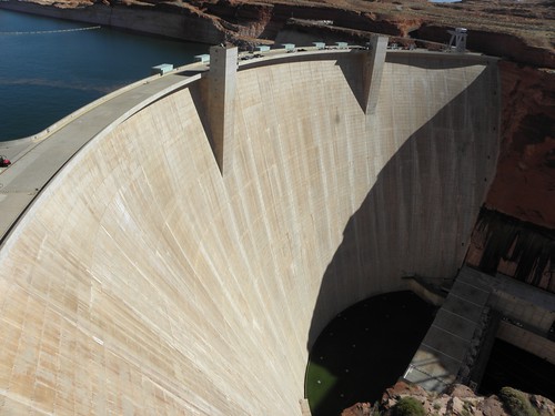 |
| An environmental disaster, yesterday |
They will make more money if there is actually a member of staff on the till in the gift shop. I wanted to give you seventeen of your Earth dollars in exchange for a Shiny Book, but there was no-one there to whom I could give the cash. Because I am honest, I put it back on the shelf rather than walk out with it.
And that:
The character in "The Wind In The Willows" who said:
Believe me, my young friend, there is nothing - absolutely nothing - half so much worth doing as simply messing about in boatswas not called fucking "River Rat"

The bridge is nice though. Well, CrinklyLion thinks so.
Once I'd found the not-terribly-well-signposted detour all was well. Better, anyway. The road used was formerly called "Bia-20" as it runs through the Navajo Nation (I have just worked out that "Bia" is Emily-speak for "Bureau of Indian Affairs"), and was not surfaced. The Nice People from ADOT spent 35 million dollars on tarmac and the result is luvverly and smooth. Right at the end then left onto US-89A to Navajo Bridge.
Of which there are two; the new one opened in 1995 as the 1929 version was deemed unsuitable for modern-type Heavy Things.
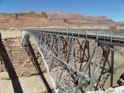 |
| Old Navajo Bridge - the new one can be found in the "Travels 2003" album on flickr |
The bridge is about 1100 metres above sea level, this being the lowest point of the trip so far. I would have gone lower, to Lee's Ferry, but the people who run the Glen Canyon National Recreation Area want fifteen dollars to drive a few miles up a dead-end road. Lee's Ferry is named for one John D. Lee, a rather nasty piece of work who had participated in the Mountain Meadows Massacre of 1857, in which 120 emigrants from Arkansas were killed utterly to DETH by Latter-Day Saints, about whom there appeared to be very little that was Saintly. Rather than being decently hanged by the neck until very unhappy, Lee was shuffled off to this remote corner and ran a ferry across the Mighty Colorado until his subsequent arrest and execution by firing squad.
From here it's a long uphill to Jacob Lake, much of it through pleasant conifer forests rather than the semi-desert scrub down below - Jacob Lake is at 2450 metres and is also the entrance to the North Rim of the Grand Canyon. If you should hanker after visiting the Grand Canyon then this Unit endorses wholeheartedly the North Rim as it's utterly untouristy.
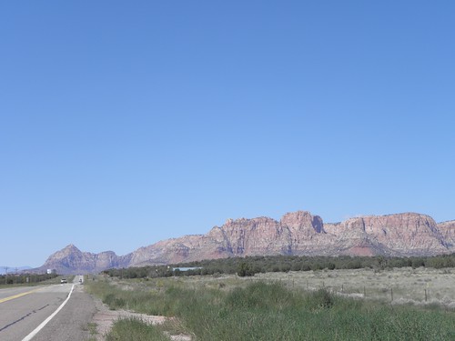
Then back down a bit and turn left in Fredonia, through Colorado City and back into Utah before plummeting down into Hurricane. Colorado City also has an unsavoury connection with (Fundamentalist) Latter-Day Saints and I'm still trying to decide whether these Rocks:
are the ones on the cover of Jon Krakauer's book "Under The Banner Of Heaven" which, among other things, details some of the nasty goings-on in these parts by Fundamentalist Mormons.
And so onto I-15, the descent of the Virgin River Gorge being spoiled this time by lane closures and extreme warmth, and down to Mesquite, just over the state line in Nevada. I just got back from getting some nosh, well after dark, and it was still about thirty-six of your new-fangled EU-mandated ["Who do you think you are, Douglas Carswell MP?" - Ed.] Retrogrades. Even hotter in Lake Havasu City tomorrow, which just happens to be where I'm heading. It's only 224 metres above sea level too; Mesquite is double that. It's getting too thick to breathe...
On milk: as any fule kno, everything is Bigger in USAnia. Except their pints, obv. Which is why if you want to buy a pint of milk, that one might have Proper Tea
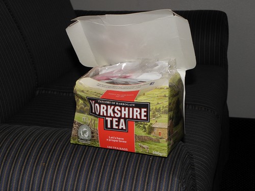 |
| Proper Tea is Theft... |
- Note to the BBC, and other idiots, they are "children". Not "kids". Homo sapiens sapiens, not Capra aegagrus hircus.

No comments:
Post a Comment
O hai, spammers!
All comments are moderated so don't bother.
Kthxbai!