Firstly, y'all will no doubt be pleased to learn that I appear only to be suffering from a clod rather than some more advanced form of Lurgi, thought whether the assorted aches besetting this increasingly decrepit body are due to old age, viruses or just sitting in an unfamiliar motor-car remains to be seen. Still, at least motor-spirit is rather cheaper in this part of the world than it is in California, home of the rob-dogs. Also I am full of Filthy Pizza, which has improved my mood no end.
As observed yesterday, I orter ov gone to Arrow Rock on the way to Marshall but didn't, so rectified this omission this morning. Arrow Rock has a population of 56 and I think they were all in church when I got there; also the Visitor Center doesn't open until hours 10:00. It's pretty nifty inna tourist trap stylee.
 |
| Main Street, Arrow Rock |
Thence to Fort Osage. The Corps of Discovery camped on what would become the site of the fort, and Clark returned in 1808 to build it. In spite of the name it was more a trading post or, as it were, Factory for swapping shoddy tat for furs collected by the Native Americans.
 |
| Shoddy tat store, Fort Osage |
 |
| Fort. Missouri. Sunday. |
The War of 1812 didn't help, because us perfidious BRITISH told the locals that they could trade with the Hudson's Bay Company and get much better quality BRITISH Stuffs and if you wouldn't mind burning down a few American outposts that's be just dandy. Eventually Big Bizness put the Federal Government's trading policies out of their misery and the place was abandoned and recycled by the local Eurotrash. The current version was built after WW2 and is quite a lot smaller than the original, on account of the burghers of Sibley hauling goods up from the river with oxen, leaving a bloody great 'ole in the middle of what used to be the fort.
The urban sprawl of Kansas City next, as they have a nifty statue of divers members of the Expedition up on the hill overlooking the confluence of the Kansas and Missouri Rivers. This side features Lewis, Clark and Sacagawea:
 |
| But where did Clark get that smartphone? |
while t'other is York and Seaman.

York was Clark's slave and rather hoped be be freed once the journey was over. While historians are agreed that this didn't happen immediately the party returned to St Louis, opinions vary as to what actually did happen to him. See https://en.wikipedia.org/wiki/York_(explorer)
Crossed the river into Kansas, specifically Atchison. Being the birthplace of pioneering aviatrix Amelia Earhart, whose disappearance during a round the world flight in 1937 led to numerous conspiracy theories and at least one concept album1.

Just up the road is Independence Creek, so named because this was where the Corps camped on the 4th of July 1804. Not much there unless I didn't look in the right place.

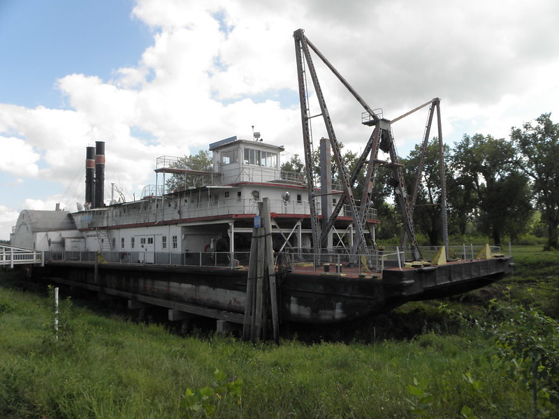 |
| The Captain Meriwether Lewis |
Broadcaster Jack de Manio once said of Glenda Jackson that "she had a face that could launch a thousand dredgers" but poor Lewis only got the one. Also it took until 1931 to launch it. On the other side of the river lies Missouri again but after a short blast up I-29 it turns into Iowa thus making four states today.
Also I really should have applied the old sun-schlog today as my fishbelly-white appendages have turned quite red. Ooops.
- "In Search Of Amelia Earhart", Plainsong, 1972


No comments:
Post a Comment
O hai, spammers!
All comments are moderated so don't bother.
Kthxbai!