Sunday 31 August 2014

Day 10: Yuma, AZ - Hemet, CA

Deserts be damned, I feel like some more mountains.  They look nice and, being closer to the sun, tend to be cooler ["Are you sure about this?" - Ed.].  The only flaw in this plan is that the nearest available mountains lie quite some distance away, across some very dulk deserts.

Mostly dulk anyway.  Not far into Stullifornia are some ripping sand dunes:
Peter O'Toole & camel just out of shot
The road in the foreground is the westbound carriageway of I-8, the rest area at which I stopped being built on the central reservation.  Just behind the bushes in the middle is the All-American Canal.  It's a bit rubbish - no locks, no pubs and, indeed, no boats.  It instead serves to supply water to the Imperial Valley, with a subsidiary use of drowning illegal immigrants - such is the number of people killed utterly to DETH in the canal that it has been called "the Most Dangerous Body of Water in the U.S."

The Imperial Valley is not much different from a fair amount of the terrain crossed yesterday i.e. it is dead flat.  Almost.  It actually slopes down towards the Salton Sea; thus much of it is well below sea level - as far as seventy metres in some spots.  The only thing worthy of note here is the aforementioned Salton Sea.  While the area has frequently been filled with water for natural reasons, the current Salton Sea is the result of a cock-up in the opening overs of the twentieth century which caused the Mighty Colorado to turn sharp right and inundate the area to a depth of about 16 metres in the middle.  The pelicans like it, though.
The Salton Sea at Bombay Beach, CA
What you cannot see in this picture, because it is behind me, is the Mudstang up to its axles in soft sand.  Yes, like Wild Billy Childish1, I am a Stuckist.  Fortunately a Nice Man showed up armed with a pickup, some sturdy chains and equally sturdy webbing straps and a  SHUVEL.  With these we were able to tow the Mudstang back to Terra Firma.  I disrecommend any SHUVEL-related activity on a shade-free beach when the temperature is in three Fahrenheity Digits.  You may, should you so desire, call me a twat.

Just this once.

Leaving the smelly old Salton Sea behind we encounter the area of urbanisation and golf courses that is the Coachella Valley.  Either side of this there are, at last, mountains.  I pick those to the west, the Santa Rosa and San Jacinto ranges, find CA-74 and enjoy a splendidly twisty climb to ~1400 metres and a commensurate temperature drop to around 32 Celsius.  Mountain Center sounds like it should be a nice place to stop but alas is too small to support much more than a caff and a road junction.
The bustling heart of Mountain Center
So here I am in Hemet, which is down the other side of the mountains about 500 metres above sea level and about ten miles long.  Nice Lady Tonya at the motel and I have a good chat while the housekeeping staff work frantically to get all the rooms ready - apparently they're usually fully booked every weekend, not just Labor Day, so I was lucky to get in.  Alas my window faces west and the air-con is not up to the task, but the free cookies and already-in-the-fridge bottled water help make up for it.  I haven't ventured out since arriving but will have to do so soon in order to buy milk.  Hat, sunglasses and Native Bearers with tinned quail and copious quantities of Gin are all ready to move out...

On being Stuck: On the whole it is probably better to be in the company of a taciturn Hispanic bloke with a SHUVEL than having Tracey Emin shouting that you're "stuck! stuck! stuck!" in your ear'ole.

  1. OK, not much like Wild Billy Childish...

Saturday 30 August 2014

Day 9: Lake Havasu City, AZ - Yuma, AZ

Yet another short day.  It seems old age is turning me into some kind of wuss - I've only scraped over 400 miles once so far.  Anyone with more time on their hands than is healthy can correlate the distance driven against the number of photographs taken, and then keep the information to themselves.  You should be grateful, especially if you like Bridges...

I am afraid I have started to think of last night's resting place as Lake Haversack City.  This is right up there with Cheesypeas Bay.  Or possibly down there.  You be the judge, and keep your conclusions to yourself.  One thing to like about the place is this: when approaching from the north, you pass a shopping mall just off the main road.  The road leading down to the mall is called "The Shops Boulevard".  I kid ye not.

It was a hot day from the off with the temperature exceeding a hundred Fahrenheits practically as soon as I'd fed the Mudstang some more motor-spirit.  At least yesterday it crept up on me gradually.  Both this afternoon and this evening saw brief bursts of 121 degrees, which is hot enough to melt your ears, and I wimped out at lunchtime and put the roof up and the air-con to 11.

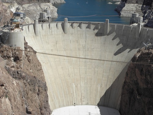
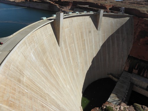
The run down to Parker Dam is quite nice really, and unlike the Hoover Of That Ilk, it's practically deserted.  It has Roots Buried Deep into the Earth, or at least into the bed of the Mighty Colorado so although it's not as impressive on the surface as some of the Big Boys, it can boast some serious numbers to those who care about such things i.e. not me.
The country flattens out downstream of the dam and it's all agricultural and has roads with twenty miles long straights which nearly caused me to fall asleep.  I managed to find a suitably shady spot for a spot of rest, although it wasn't very quiet:
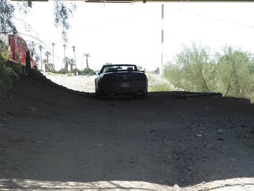
Mudstang and Englishman not going out in the mid-day sun...
What you can't really see in the picture is that the horizontal line at the very top is the lowest extremity of a bridge span.  In this case the one carrying I-10 across the Mighty Colorado.  I am this: jealous.  Of the people mucking about on the water, whether on jet-skis or in 1000 bhp speedboats that make the dog's ears stream back horizontally.  Here is a man taking his dog for a walk in the middle of the Mighty Colorado:
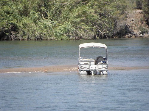
(Small brown dog on sandbank to left of boat)
US-95 south from I-10 offered a different kind of ruler-straight dulkness as it climbs off into the desert and is flanked by US Army proving grounds such that a picnic area is also home to half a dozen different self-propelled guns and the junction with Imperial Dam Road is guarded by a couple of GBFO artillery pieces.  Imperial Dam is a low-rise affair and is for irrigation and water supply, and thus the primary reason why the Mighty Colorado is very much less mighty from here to the sea.  On the rare occasions when it retains enough water actually to make it to the sea at all.  You can't even see it from the back terribly well, still less from the downstream side, and all the other significant features of the Mighty Colorado around here are similarly concealed.  You can scarcely tell which of the shedload of channels is the actual river.
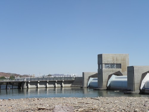
The upstream side of Imperial Dam.  Not a bad picture considering I had to hold the camera at arms' length above my head...
Again the land flattens bigwise and gets agricultivated.  It's like the Fens with date palms.  Nothing to see until you get to Yuma.  The bit of Yuma wot I is at is the site of the Yuma Crossing, which was a significant crossing point of the Mighty Colorado from pre-Columbian times and still has three bridges today.
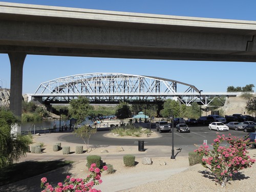
Triple Bridgey Goodness: I-8, Penitentiary Avenue, railroad.  Latter complete with train!
To commemorate the arrival of the horse-drawn Zeppelin railroad there is also this, smack next door to the hotel:
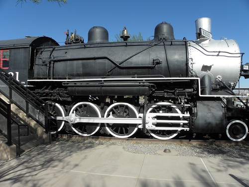
Southern Pacific locomotive 2521
I nearly gatecrashed a couple's wedding photos while snapping the above...  And I can see the Mighty Colorado from my window, or I could until it got dark.

On unresolved issues: There are two, viz.

  1. Where shall I go next?  I'm not enamoured of the prospect of going to the seaside on a Bank Holibob weekend, and
  2. Where I can I buy some fags?  I'm on the last packet of duty-free...

Friday 29 August 2014

Day 8: Mesquite, NV - Lake Havasu City, AZ

It is now 8:40 pm and I have just got back from buying milk.  It is 42° C out there.  So, a fair bit cooler than when I arrived, when it was pushing 48°.  And there is an "Excessive Heat Warning out for Yuma, AZ, tomorrow.  Guess where I'm heading?

Lake Havasu City.  Let's get the obvious out of the way:
A bridge, yesterday
Yes, that's the old London Bridge.  Sort of - it's the stone cladding of the 1831 original over a concrete core.  And Robert McCulloch knew full well what he was buying - anything you may have heard about Tower Bridge is bollocks an urban legend.  Also it's full of speed boats.  I keep expecting God (played, of course, by James Mason) to show up, saying "Noah!  Build me an Ark!"

Rewind to rejoining I-15 this morning.  The stretch of said freeway from the Utah state line to Las Vegas is unremittingly dulk.  Watch an episode of "CSI" where the victim is found out in the desert.  It's like that.  For about eighty miles.  No thanks.  Instead I turned off to follow NV-169, a.k.a. "Northshore Road", because it follows the North Shore of Lake Mead.  Geddit??  Well, it follows the wet at a distance of about a Several of miles, but it's not the freeway and is pleasingly three-dimensional in places.  Also the entrance station to the Lake Mead National Recreation Area was firmly shut, so I didn't have to pony up ten bucks to use it after all.

This brings you out close enough to the Hoover Dam as makes no odds, where much has changed since I was last here in 2010.  For a start, They didn't want to search the Mudstang.  And the dam is no longer part of US-93 as the bypass bridge opened to traffic about a month after my last visit.  You can now get a much better view of the dam from the bridge, though those of a nervous disposition should be aware that the bridge deck is 880' / 270m above the Mighty Colorado.
The Hoover Dam.  Big, but not particularly clever.
The bridge is officially known as the Mike O'Callaghan-Pat Tillman Memorial Bridge and there are some spiffy plaques up at the deck to tell you all about the pair.  Of them.  Interestingly, the biographical sketch of Pat Tillman fails to mention that his death in action in Afghanistan in 2004 was the result of a friendly fire incident but I suppose that rather goes against the grain.  It's not a bad bridge, but give me the Viaduc de Millau any day.
I couldn't be arsed to walk all the way down to the centre of the dam as while it was not yet midday it was still 100 of those Fahrenheit thingies, and the vicinity is full of people who park like fuds.  No, Sir, you cannot stop dead in the middle of the roadway with your motor-car and collapsible caravan combo in the vain hope that someone is going to free up a parking space.  Especially since all the spaces there are for cars.  Cars with trailers, GBFO motorhomes, buses etc. will have to go to the Nevada side and pay up.  Or go halfway across the dam, drop the clutch and turn sharp left.  Your choice.

Also new is the fact that you cannot get out onto US-93 at the Arizona end.  Emily had this sussed since she was purchased after the bridge was opened, but Idiot Boy here didn't pay attention.  I made it out eventually, drove over the bridge, turned round and drove back.  They've built the walls high enough that you can't see anything from a normal-sized car chiz.

So back towards Vegas and then south down US-95.  There are a Several of reasons for going this way to Laughlin / Bullhead City.

  • It's shorter.
  • It may be less thoroughly dulk than US-931.
  • It passes through the intriguingly named "Cal-Nev-Ari" which, in spite of appearances, is not a firm of minor-league villains from Finsbury Park2.

Laughlin is famous largely for the River Run Riot of 2002, and has a fairly anonymous bridge o'er the Mighty Colorado to Bullhead City.  Laughlin has the casinos, Bullhead City the hotels and "gas" stations, since motor-spirit appears to be about fifty cents a gallon cheaper in Arizona than it is in Nevada.  Bullhead City goes on for miles with a 45 mph speed limit and about a thousand sets of traffic lights, perfectly phased to ensure that you have stop at Every Single One.  This is made of Fail, so it was a relief to cross back into Nevada on the Aztec Road bridge.  I personally wouldn't have named a road after a notoriously bloodthirsty bunch from south of the Rio Grande, but back in Logandale there's a Yamashita Street.  I hope it's named after someone other than the Tiger of Malaya, especially as the USA executed him for war crimes in 1946.

The Nevada side is only about half a mile long, though, because the road makes a discreet entry into California and runs parallel to the Mighty Colorado down to Needles.  Very bumpy and with lots of dips to accommodate the flash floods coming out of the mountains to the west.  Not today, obv., as it's 117/47 in Needles.  Which has a bridge, but not a very exciting one.

Onto I-40 for a bit.  I think I missed this part in 2010, but I didn't miss much.  Then south on AZ-95 to Lake Havasu City and London Bridge.  And a lizard in my room.
Obligatory "Reptilian Overlords" nonse goes here
As long as he sticks to scoffing insects rather than my toes, I'm happy to share.

I've also learned today that the Mudstang has a USB port and if you plug the iPod into it, you get a Ford logo on the screen and, I imagine, the ability to control it from the car stereo rather than having to prod the iPod itself.  But I don't know, because in their infinite wisdom, Budget didn't supply The Fucking Manual with the motor-car, so I now have to peruse the downloaded version instead.

On The Lizard Alliance: It may just be a coincidence that a lizard with the longest ration of lizard:tail I have ever seen shows up in my room while outside are these:
Entrances to the Lizard Alliance's SEEKRIT Bunker?
Or is it?  OR IS IT??  ["Yes.  Yes, it is" - Ed.]
  1. It wasn't.
  2. Cal-Nev-Ari looks like a trailer park with ideas above its station.

Thursday 28 August 2014

Day 7: Page, AZ - Mesquite, NV

So, long day or short day?  It's nice to have the option and, when the end of the long option includes close proximity to Las Vegas, well, no contest.  Hence I rocked up here in Mesquite not long after check-in at the hotel opened for business.  Just as well too, as I was melting.  It was 41° when I arrived (106° in old money).  Trufax: when the BRITONS' Broadcasting Corporation used to accept comments on just about everything, some confused helmet would continually rail against Auntie's use of creepy metrificated FOREIGN Celsius as opposed to honest Queen-fearing BRITISH Fahrenheit.  I can only assume that the poor sap really did believe that Danzig is a small village near Chipping Norton.

Anyway, you won't find any of that metric nonsense over here.  The Mudstang's instruments can be switched to metric, I imagine as a sop to those heathen Canadians, but I haven't bothered in case the car dobs me in to Homeland Security.  Note to self: do not wear that T-shaped shirt with the picture of Karl Marx on it until you get to Battle Mountain.

Today should have been relatively straightforward from a navigational perspective.  Emily has already had her annual brainstorm, yesterday.  Who can forget her sudden aversion to Des Moines last year?  This year it was "In one mile, turn right".  No, Emily, I am not taking the Mudstang up there.  In fact, I'd think twice about using that "road" in a Lard-Rover.  And already on this trip we've had Fall River Road in RoMo NP closed and the Hall's Crossing - Bullfrog Marina ferry across Lake Powell not running, which is why you'll have to go back to 2011 to find a picture of the UT-95 bridge.  Plan was to go across the bridge and back on the ferry.  Bah!

Last night I thought I'd work out some distances, using a Famous Web Search Engine Maps.  Why are you sending me all the way down there (about forty miles off the logical course)?  What is this US-89T of which you speak?  Eventually I discovered that the bit of US-89 south of Page has been closed due to landslide damage for eighteen months.  Road signs to this effect are not prominent in Page.  And Emily wouldn't have known about it because I balked at the price Garmin ask to update her maps.  Bah encore!

The first target today was the Glen Canyon Dam and neighbouring bridge.  The former is Wrong on many levels, but obviously they tend to gloss over this at the Visitor Center.  Apparently a heavy El Niño in 1983 dumped so much SNO in the Rockies that the resultant thaw threatened to wash the whole thing away and what a good idea that would have been.
An environmental disaster, yesterday
And the pogues who run the Visitor Center need to be aware that:

They will make more money if there is actually a member of staff on the till in the gift shop.  I wanted to give you seventeen of your Earth dollars in exchange for a Shiny Book, but there was no-one there to whom I could give the cash.  Because I am honest, I put it back on the shelf rather than walk out with it.

And that:

The character in "The Wind In The Willows" who said:
Believe me, my young friend, there is nothing - absolutely nothing - half so much worth doing as simply messing about in boats
was not called fucking "River Rat"

The bridge is nice though.  Well, CrinklyLion thinks so.

Once I'd found the not-terribly-well-signposted detour all was well.  Better, anyway.  The road used was formerly called "Bia-20" as it runs through the Navajo Nation (I have just worked out that "Bia" is Emily-speak for "Bureau of Indian Affairs"), and was not surfaced.  The Nice People from ADOT spent 35 million dollars on tarmac and the result is luvverly and smooth.  Right at the end then left onto US-89A to Navajo Bridge.

Of which there are two; the new one opened in 1995 as the 1929 version was deemed unsuitable for modern-type Heavy Things.
Old Navajo Bridge - the new one can be found in the "Travels 2003" album on flickr
The access road onto the old bridge is now a small Navajo craft market and as I already have a dreamcatcher I bought here in 2003 (Miss von Brandenburg got custody of the Joint Dreamcatcher) I am now the proud owner of a very Silly Hippie hematite arrowhead necklace.

The bridge is about 1100 metres above sea level, this being the lowest point of the trip so far.  I would have gone lower, to Lee's Ferry, but the people who run the Glen Canyon National Recreation Area want fifteen dollars to drive a few miles up a dead-end road.  Lee's Ferry is named for one John D. Lee, a rather nasty piece of work who had participated in the Mountain Meadows Massacre of 1857, in which 120 emigrants from Arkansas were killed utterly to DETH by Latter-Day Saints, about whom there appeared to be very little that was Saintly.  Rather than being decently hanged by the neck until very unhappy, Lee was shuffled off to this remote corner and ran a ferry across the Mighty Colorado until his subsequent arrest and execution by firing squad.

From here it's a long uphill to Jacob Lake, much of it through pleasant conifer forests rather than the semi-desert scrub down below - Jacob Lake is at 2450 metres and is also the entrance to the North Rim of the Grand Canyon.  If you should hanker after visiting the Grand Canyon then this Unit endorses wholeheartedly the North Rim as it's utterly untouristy.

Then back down a bit and turn left in Fredonia, through Colorado City and back into Utah before plummeting down into Hurricane.  Colorado City also has an unsavoury connection with (Fundamentalist) Latter-Day Saints and I'm still trying to decide whether these Rocks:
are the ones on the cover of Jon Krakauer's book "Under The Banner Of Heaven" which, among other things, details some of the nasty goings-on in these parts by Fundamentalist Mormons.

And so onto I-15, the descent of the Virgin River Gorge being spoiled this time by lane closures and extreme warmth, and down to Mesquite, just over the state line in Nevada.  I just got back from getting some nosh, well after dark, and it was still about thirty-six of your new-fangled EU-mandated ["Who do you think you are, Douglas Carswell MP?" - Ed.] Retrogrades.  Even hotter in Lake Havasu City tomorrow, which just happens to be where I'm heading.  It's only 224 metres above sea level too; Mesquite is double that.  It's getting too thick to breathe...

On milk: as any fule kno, everything is Bigger in USAnia.  Except their pints, obv.  Which is why if you want to buy a pint of milk, that one might have Proper Tea
Proper Tea is Theft...
of an evening, you have to pay through the nose for it, as pints of milk seem solely aimed at children1.  I bought one the other day which rejoiced in the name "Moo Juice".  Right there on the bottle in large friendly letters.  Do these people have no shame?
  1. Note to the BBC, and other idiots, they are "children".  Not "kids".  Homo sapiens sapiens, not Capra aegagrus hircus.

Wednesday 27 August 2014

Day 6: Moab, UT - Page, AZ

Again the Automatic Diary may be delayed due to notwork issues.  I'm pretty sure it's not the Babbage-Engine at fault as the iPad and Kindle are also flakier than a double 99 when they try to connect to the Intertubes.  This is getting annoying.

I didn't buy a spork in the end, but am pleased to report that the Shell station on Main in Moab will still sell you "gas" on your credit card without all that tedious "ZIP Code" nonsense.  As will the one in Kayenta, AZ.  The Chevron opposite the latter won't, so yar boo sucks.  It's nice not to feel pressured for time and/or the apparent need to Get Somewhere, so I started the day with a detour up Castle Valley and over the La Sal Mountain Loop and Geyer Pass Roads.  Fifty-odd miles to get back near enough to where you started.  The run around La Sal Mountain goes up to more than 2400 metres - Moab itself is about 1200 - and would be Teh Awsum in a lightly warmed-over Mini Cooper.  An Issigonis one, not that BIGI monstrosity they churn out of Cowley these days.
More insane Rocks, these from somewhere up the La Sal Mountain Loop Road
There is a property for sale on the Moab side - contact Moab Realty on +1 435-259-6050 if interested.  It's 2300 metres up and twenty miles from town, though, so it'll be cold in the winter and would require dedication to cycle to the shops or the pub.

And then back down US-191, in a repeat of yesterday's performance.  Only this time a bit further, to the Needles section of Canyonlands National Park.  Canyonlands, like Gaul, is divided into three parts and Needles is one of them.  The other two are The Maze and Island In The Sky.  The minor road runs for forty miles out to Big Spring Canyon Overlook, where the view is not nearly as exciting as those to be had elsewhere.  Strictly minor-league Rocks:
And these two feathered pikeys. 
"'ere, Bazza, 'ave you seen that Hitchcock film..."
They may look as though they are innocently perching on the Mudstang but they're actually robbing my rucksack on the front passenger seat.  They'd already got one compartment open and attempted to eat the contents viz. the small bag containing my headphones and iPod lead, and were making a good fist beak of opening another.  Cheeky fuckers.

So, another forty miles back to the main road, as while the road atlas showed a minor road off to the south, it was not apparent on the map handed out by the Park bod.  Or on the ground.  Or on Google maps.  All in all a bit of a waste of eighty miles of motor-spirit.  And it rained on the way back.  A lot.

I could have taken the main road all the way to Mexican Hat, but that would have deprived me of UT-261.  Most of this is an altogether normal two-lane blacktop, but after twenty-three miles of being sensible it halves in width, loses most of its tarmac and plummets off a cliff.  Miss von Brandenburg wouldn't like it at all.  So where would we find today's motorised moron?  Stopped smack in the middle of the road so that Mrs Moron could take photos.  Of this:

Not far past Mexican Hat is Monument Valley.  I've done Monument Valley - go and look at the "Travels 2003" album on flickr if you need a fix, or watch a John Ford western.  Anyway, I didn't go there this time, just as I'm not going to the Grand Canyon tomorrow.  The sight of Big Lumps of Rock bring Motorised Morons out of the woodwork in their dozens; one was standing in the northbound lane of US-163, oblivious to the bus-sized motorhome bearing down on him at sixty miles per hour, while another two had got their crappy Chevy stuck in soft sand two feet from the edge of the cabbageway.

After Kayenta, things get rather dulk except that you lose lots of altitude to get down to Page.  Page is all new and shiny as it was only built in 1957.  Something to do with the Glen Canyon Dam, which is but a mile or two from where I sit.  And being in Arizona, I have gained an hour.  Utah is in the Mountain Time Zone and thus seven hours behind That London.  Arizona, on the other hand, is in the Mountain Time Zone and thus is eight hours behind That London.  Arizona, y'see, doesn't use Daylight Saving Time, so it's seven hours in the winter and eight in the summer.  Unless you're in the part of Arizona which is also part of the Navajo Nation.  Which does use Daylight Saving Time.  Confused yet?

On WTF: seven miles from one of the biggest hydro-electric schemes in the whole country is... a coal-fired power station.  I have not the words.

Tuesday 26 August 2014

Day 5: Grand Junction, CO - Moab, UT

Apologies for the potentially late arrival of this instalment, but the Internet connection here is flakier than a three day old croissant, so I'm typing this locally with a view to bunging it online when the motel's Anbaric Clever decides to talk to the outside world again.

I am beginning to think that Dave Lee Roth actually made good on his threat to destroy Muzak - the tunes in the motel lobby in Grand Junction included Steely Dan, The Kinks, Creedence Clearwater Revival and The Who.  On the other hand the Wireless-with-Pictures in the breakfast area was showing Fox "News".  Apparently Egypt and the UAE have bombed Libya without asking permission first, and various USAnian Congressional stooges are up in arms about it.  Quite right too, it's not as if the USA would launch air strikes on Libya without, er, as you were.

If you look on the map, you will see that Grand Junction and Moab are not really very far apart at all, and further that the Mighty Colorado disappears into the wilderness shortly after Fruita.  So I took the opportunity to visit some of the bits of Scenery adjoining Canyonlands National Park that I missed in 2003.  But first...  I managed to find the junction on I-70 which takes one to the Scenic Route - UT-128 - into Moab, following the Mighty Colorado during its brief reappearance into Civilisation at Dewey Bridge.

The remains of Dewey Bridge.  It is not recorded whether there were ever Huey and/or Louie bridges.
It was built in 1916; fortunately there is a more recent one off to the left which hasn't fallen to bits.  I've mentioned the canyon through which the Mighty Colorado passes hereabouts, but I can't remember when.  2010, actually.

At US-191, two miles north of Moab, is the last bridge over the Mighty Colorado for some considerable distance, as the river once again vanishes into the hinterlands where you can't get at it without a boat or a proper 4WD vehicle.  You can follow the river some seventeen miles further on UT-279 past the Cane Creek potash mining and processing facility, but there's not much there except a potash mining and processing facility, some railway sidings and a large quantity of Rocks.  Backtrack from here, north a few miles up US-191 and then left on UT-313.  This is the access road to the Island In The Sky area of Canyonlands NP (approximately 1/7 of a Wales in area, comparison fans) and also for Dead Horse Point State Park.  Dead Horse Point itself is only about four miles from the potash wossname as the vulture soars, but it's also two thousand feet higher up so the views are quite spectacular.  The ham and egg wrap was nice too.

The Mighty Colorado from Dead Horse Point
The next place on the agenda is Needles Overlook.  On a clear day you can probably see this from Dead Horse Point, but it wasn't a clear day.  Rain was visible to the south-west, y'see.  To drive there from Dead Horse Point is almost ninety miles, so not quite as impressive as the gap 'twixt North and South Rims of the Grand Canyon but a fair flog all the same. 

On the southern edge of Moab there are road works.  Carwash! says the flagger controlling the single-line operation as I pass.  Clever of him to notice.  Anyway, quite some distance south of Moab is a junction, from whence a madman felt it a good idea to build twenty-two miles of road through bugger all to get to the edge of the plateau.  It's worth it, though.  You pop over a rise about a mile from the end of the road and there's this insane jumble of rocks, mesas, rocks, buttes, rocks and occasional glimpses of the Mighty Colorado.
Rocks.  America.  Tuesday.
It was a pity some petty-minded little twat had carefully broken open the locked frames containing the interpretive maps and nicked every single one, as this made identifying the Scenery next to impossible.  You can spot a potash evaporation pond from quite a long way away because of the colour, and the Mighty Colorado likewise, but which particular bunch of rocks are those?  Needles Overlook is also where the Lizard Alliance is starting its campaign to enslave humanity:
I for one welcome our new reptilian overlords...
I almost decided not to go to Anticline Overlook as:

  1. I feared it might be an Anticlimax Overlook (do you see what I did there, eh?), and
  2. The quantity of motor-spirit left in the tank looked a bit marginal for the 34 mile detour on top of the sixty-plus back to Moab.

But I went anyway.  Seventeen miles of rather dulk gravel roads which proved that:

  1. 50 mph is a silly speed when the gravel gets deep, and
  2. The seals on the Mudstang's boot lid are far from dust-proof.

It was worth the trip, especially as the rain held off until I arrived.  The roof had been down for the whole day up to this point, so I can't really complain.
Potash evaporation ponds with the Mighty Colorado in the foreground
And then back to Moab.  With, as it turned out, twenty-six miles-worth of motor-spirit left in the tank.  Last time I was here was in 2012, when I was Crippled by Crappy Chrysler.  Fortunately when Chrapsler revamped the 200 range earlier this year they dropped the convertible   And Moab may be one of the best places in USAnia to make good my threat to obtain a spork to consume my breakfast cereal.  In 2012 I was at the other end of town; this year I'm almost opposite 900 North Main Street, the Sunset Grill.  This was formerly the hilltop mansion of "Uranium Charlie" Steen who first discovered uranium in these parts, making himself rich and putting Moab firmly on the map.

On beds: The bed in here is advertised as "Queen size".  I know Missis Kwin has shrunk a fair bit since the Coronation but I think even she'd be hard-pushed fully to stretch out on one of these.

Monday 25 August 2014

Day 4: Kremmling, CO - Grand Junction, CO

Those who care about such things will no doubt be relieved to learn that I am not bed-ridden in a fiendishly expensive USAnian hostipal as whatever ailed me yesterday has been seen off by a just-about-tolerable night's sleep.  The said sleep being b0rked by a combination of America's second-loudest fridge1 and the wik thunderstorm, whose accompanying torrential rain did its best to clean the scum off the streets muck off the Mudstang.  More rain in the morning too; the two bikers with whom I'd been chatting at breakfast (one of whom was a refugee from Ealing, living in LA for thirty years, and who can blame him?) took cover under the motel canopy until it had blown over.

I wasted a fair bit of time looking for County Road 11 to take me down to the Mighty Colorado; Emily and I thought we knew where it was but it seemed to be naught but a five-yard stub leading to a steep hillside liberally coated with pine trees.  Back to Kremmling and Plan B, in the shape of County Road 1, a.k.a. Trough Road.  The Mighty Colorado faithlessly diverts from major thoroughfares around here, so I had to take to the back roads.  Mostly smooth dirt, with a nice fresh layer of liquid mud.  More forgiving on the motor-car than the A406 at the Waterworks roundabout, anyway.


Emily can be told to look for coordinates rather than places, so a little forward planning with Google Maps and the iPad meant a list of suitable places to visit could be drawn up in advance and referenced on the move.  What I didn't expect to find was the tail-end of Gore Canyon:


Above the Mighty Colorado on the left is what used to be the Denver, Northwestern and Pacific railroad - now part of the Union Pacific.  Above the Mighty Colorado on the right, and just out of shot, was a very soggy mountain biker cooking Porridge and drying out his tent...

Although much of the Mighty Colorado hereabouts looks only marginally more exciting than the Llangollen Canal, Gore Canyon contains some serious rapids, hence the proliferation of rafting tour operators even out in the middle of nowhere.  One such piece of the middle of nowhere is Radium; they used to mine the stuff here in the early 20th century.

Radium.  Monday.
Trough Road goes for miles (mostly) along the river to State Bridge, where one can enjoy a brief return to asphalt on CO-131, before turning off onto County Road 30.  This is also most dirt, at least at the eastern end, and sticks as close to the river as it's possible to get without either a train or a boat.  I nearly made good on my desire to own a less dumbphone around here, in the form of a Jesus phone iPhone which someone had left at the Catamount Recreation Site, but unfortunately it was DED:
I was tempted to drop it off the nearby bridge, just to see if it really could walk on the water...
Eventually the road turns tarmaccy and then runs smack into I-70 at Dotsero.  There are Good Motorways and Bad Motorways.  Bad Motorways include the M25 and most of I-80 between Cheyenne and Battle Mountain.  I-70, from its inception in Utah as far as the outskirts of Denver, is a Good Motorway, and few bits are better than Glenwood Canyon.  I've writted of Glenwood Canyon before, so you'll have to check the Archives.  Here may be found more top Bridgey Goodness, most of it unphotographable because the bridges carry the road over the Mighty Colorado.  Hanging Lake Rest Area, though, offers some top bridge-spotting opportunities:
Some nameless dam in the foreground; railroad disappears into a tunnel behind the bush on the far left.
One day I'll actually walk the mile-and-a-bit up to Hanging Lake, but not today.  Miss von Brandenburg will no doubt be mortified to learn that my top-quality Firetrap Christmas Flip-Flops (which have been doing a sterling job of keeping gravel out of the soles of my feet during fag breaks) are wearing a hole in my left foot, just back from the little toe.  I have had to purchase some Equate® Strong Strips™2 to prevent amputation.
It was lovely and hot in the afternoon, which begs the question "How do you prevent your dog from getting his ears sunburned when travelling on the passenger seat of a ragtop BMW with the roof down?"  Simples:
A fine example of String Technology in action.
I hope that noise just now was a jet aircraft and not more effing thunder...

1 - The loudest is in Laramie, WY, or at least it was in 2008.
2 - Like Band-Aids, but cheaper.

Sunday 24 August 2014

Day 3: Fort Collins, CO - Kremmling, CO

Q: Where d'you think you've been, coming in at this time of night?
A: I've been out Kremmling, Mum!

Not history's most restful night, with the jet-lag catching up and next-door's air-con playing a one-note bass solo that even the most lo-fi of punks would have sneered at.  And thus unrested it's back to the hills.  South down I-25 and turn off at Loveland (confusingly, Loveland is nowhere near Loveland Pass) and pick up US-34 to take me and the Mudstang into Rocky Mountain National Park (hereinafter abbreviated to "RoMo1").  This passes through the Big Thompson Canyon, presumably named after some outsize explorer of the nineteenth century, and past the Stanley Hotel in Estes Park, which served as a model for the Overlook in "The Shining".  It's haunted, y'know.  Here is the Big Thompson Canyon:
Big Thompson was out when we called...
Paid my twenty dollars for the privet hedge of being held up through RoMo by selfish gits riding tractors Harleys.  I know they're not renowned for their handling but any bike that needs three steering corrections in the course of one twenty mile per hour corner needs to be sent to the camps for re-education.  I bailed at the Alpine Visitor Center (sic) for an urgent transfusion of coffee and CAIK.

Down a couple of thousand feet and a couple more tractors to where the Mighty Colorado becomes accessible to the public without waterproof clothing, map and compass, first-aid kit, high-energy food, water and something to frighten off the BEARS.  Auntie Charlotte is busy at the moment.
Paris, 2007: Auntie Charlotte keeping our campsite free from BEARS
Anyway, the possibly-furthest-upstream bridge across the Mighty Colorado looks very much like this:
And the Mighty Colorado with my feet in it looks very much like this:
in the mitey colorado which is joly freezing
Close to one of the Several of bridges surveyed today was this pair of right chancers:
Majestic Møøse, yesterday
Look at 'em, just snacking away on the flora like that, eh?

While attempting to photograph the next bridge downstream from the Majestic Møøse I began to feel distinctly wobbly.  Whether this had anything to do with the altitude I know not - I'd been OK yesterday and earlier today rather higher up - but I decided that further bridge-related capers should be shelved in favour of finding somewhere quiet to lie down.  This explains why I am in a slightly down-at-heel Super 8 in Kremmling nursing a cup of Tea.  But at least I have Proper Milk to put in my brew, so it no longer tastes foul due to the presence of "non-dairy whitener".  I am hoping that the diminution of altitude, an early night and Tea will sort things out.

Bah!

On televisions:  Televisions of USAnia, let us get one thing straight.  I am in charge.  Not you.  So if it turns out that the only way to put you to sleep is to pull the plug out of the wall, consider yourself lucky that the motel in question did not have a swimming pool.  Also, changing channels when I press the button on the remote would be a plus.

1 - They came for the RoMos, I laughed

Saturday 23 August 2014

Day 2: Denver, CO - Fort Collins, CO

An altogether better class of Muzak in last night's hotel: Bowie, The Byrds and The Velvet Underground.  That humming noise you can hear in the background is Lou Reed spinning in his grave.

Today's mission, and I chose to accept it, is to seek out the source of the Mighty Colorado.  Here it is:
A nondescript puddle, whence springeth a Mighty River
Can I go to sleep now? ["No" - Ed.]

OK, so out of Denver on I-70 and I-25 before turning off at Fort Collins, trundling up US-287 a bit and left at Ted's Place onto CO-14 up the valley of the Cache la Poudre river.  I have been here before and the one thing I can say with certainty is that every time I do it rains.  The roof was down from Fort Collins onwards but there was the odd shower on the way up to the turning for the La Poudre Pass, and some ominous-looking clouds over the mountains, which are big.  The Cache la Poudre is spanned by many small bridges leading off to houses; it must be very cool to have your own personal bridge.  Here is the first proper bridge to make it onto camera:
Somewhere higher up the valley than this is the turning for Long Draw Road which, thankfully, was re-opened yesterday.  However there is still a goodly quantity of logging going on hence the enforced stop after some eight or nine miles.  Are you sure you wanna take that car up here? asks the Nice Log Lady.  Yes.  Yes, I do.  It may be a dirt road but I've taken less suitable vehicles up much worse roads than this and after some fourteen miles of no tarmac which, with only a little caution, might easily have been traversed in a Ferrari, I reached the summit of the pass.  And the end of the road.  That's a rental, right? asks a jolly bearded type who has a mate in Chatham.  He insists on being photographed with a passing BRITON, to surprise the population of Kent.

The source of the Mighty Colorado is but a short walk from the summit, but matters are confused by the presence of the Grand Ditch, a man-made watercourse flowing in the opposite direction.  There may be crossings of the Mighty Colorado to be found deeper into Rocky Mountain National Park, which starts here, but I am not walking a couple of miles in pissing rain and single-digit temperatures even were I wearing proper shoes instead of Intrepid Sandals.  Doubly so at more than 3,000 metres above sea level.  Soz.

We get held up by more logging on the way back to asphalt.  As any fule kno, butane lighters do not work well at altitude chiz.  Mine don't anyway, though the current one, purchased from Poundland in Bury St. Edmunds back in February, is no great shakes at sea level either.  Here is what the Locals use to trundle about these parts; the vehicle already nicknamed the "Mudstang" is lurking at the back:
The Mudstang looks identical to the one at the top of the page.  Well, it did.  It's now a rather different colour...

The map shewed that an interesting diversion might be taken to Tie Siding via some wiggly dirt roads, but reality on the ground did not match up to M. Bibendum's paper (it often doesn't in these parts, as I found out in 2008) and I ended up going all the way to Laramie, taking in a two-minute chunk of the 2012 and 2013 return legs, before heading back to Fort Collins on US-287.

Fort Collins is the home of the New Belgium Brewing Company.  The New Belgium Brewing Company numbers among its products Fat Tire which, as well as having a pleasing bicycle connection, is also one of the first decent USAnian BEERs I met, circa 2003.  This is Not Fair and I'm now going to have a cup of tea in protest...

Friday 22 August 2014

Days 0 & 1: Larrington Towers - Denver, CO

Good day to one and all, and I declare Volume 6 of thee Automatic Diary well and truly open for business.  It is just gone 9pm in a Denver where the weather is almost indistinguishable from back in Blighty.  And they don't even have the excuse of it being a Bank Holibob over here.  First I must excuse in advance any typos as I have been using my iPad a lot recently and the keyboard is somewhat different. Plus I've got the mouse plugged into this thing, and keep forgetting, and keep swearing when the trackpad doesn't work.

Although I have not the excuse of damaged joints this year I still left my motorcar at Fort Larrington for the duration as wrestling The Luggage into the boot of a car is an order of magnitude easier than dragging it through central Londonton.  Thursday's dose of the M25 was not too horrible and the whole business of getting from Fort Larrington to Denver was remarkably smooth.  The journey to Heathrow was unremarkable, save for the muppet in a Vauxhall Insignia who decided the hard shoulder would be a good place to undertake an Italian-registered camper van.  Bag drop and security painless; ignoring the World of Whiskies duty-free shop rather less so.  Only a bit late arriving here in Denver and my cunning plan to shift from a window seat at the back of the bus to an aisle one near the front paid off, in that I only had to queue for a few minutes at US immigration.  And then spent the time saved waiting for The Luggage.  Easy enough to find the Hampton Inn & Suites too, or it was once Emily had woken up to the fact she was no longer in E17.  This post is of necessity quite short as nothing very much has happened yet, but don't forget to keep an eye out for new photos in the albums "Travels 2014" and, later, the various "BM 2014" ones too.  And "Bridges for CrinklyLion" - fear not, Crinkles, my bridge-fu is raring to go.

I haz a Mustang.  It's black 

On "service": So I tried to buy a new phone, to simplificate matter while travelling.  Phones 4U supplied a SIM-free handset, which was so SIM free it wouldn't accept the existence of mine.  Oh, they said, we will exchange it for a new one.  No good, I said, for there is insufficient time between now and my departure from Larrington Towers to permit said phone to arrive in my grubby little paw.  OK, they said, we will e-mail you a prepaid label, that you might send it back to us in exchange for a refund.  You will receive the e-mail within four hours.  This was at ~11:00 Tuesday, thus one might reasonably expect to get the thing by 15:00.  The same day.

No.  No, I didn't.  So I phoned them again at ~14:00 Wednesday and after a certain amount of faffage, determined that a prepaid label would be with me in time for the Six O'Clock News.  And guess what?

The e-mail finally dropped into my Inbox at 18:21.  On Thursday.  When the phone and I were separated by some considerable distance and about six weeks.  I'm advised that BRITAIN's economy is largely based on "the service sector" these days, in which case it is little wonder that it's such a fucking shambles.  Whither "service", Phones 4U, shower of gobbins that ye be?  Needless to say, they will not be figuring large in any plans I might have to join the ranks of the smartphone-owning in future.

Wednesday 13 August 2014

Shiny Thing Make It All Better

Do not get your hopes up, O my droogies, for the proper annual revival of the Automatic Diary is still ten or so days away.  Think of this as an hors d'oeuvre, as long as you don't want capers in it.  I can't abide capers.  The first thing I do with a Veal Holstein is put the capers carefully to one side, that I might more easily sneer at them.  They don't take any notice, of course.  They're like Millwall supporters: "No-one likes us / We don't care".

So, on Sunday 10th August I attended the Focus 12 (aka "The Gulag") Annual Reunion and a Good Time was Had.  It was nice to see a Several of my fellow zeks in attendance, all of whom appeared to be rated A1 at Lloyds.  Not to mention most of the long-suffering and infinitely patient staff (enjoy your retirement, J!) and a horde of familiar faces from the recovery community in Bury St. Edmunds.  A resounding Hurrah! for the arrival of (very) young Dylan, who will doubtless be giving his parents E & O sleepless nights before too long.  And H, I trust you'll be fully restored to (very) Rude Health before too long.

Which leads me nicely to...  Six months prior to the date of first drafting this post (for, unusually, I haven't typed this straight into BlogThing), I went shopping.  Mostly for a few last-minute wossnames prior to spending three months in the wilds of East Anglia (readers may insert their own jokes here, if you don't mind).  And a half-bottle of Scotch.  It was only when the latter was run through the scanner at the checkout that I noticed it was actually a full-size bottle.  At which point a Rational Human Being might have said "Oh, that's the wrong size.  Might I swap it for the smaller version?"

No.  No, I didn't.

The following day was my fiftieth birthday.  I aten't had a drink since.  And here is my new Shiny Thing:

NEW shiny thing make everything all better, say clever science man yesterday
In an ironic postscript to the foregoing, I was not long returned from an NA meeting on the evening of 12th inst. when the doorbell rang.  On the doorstep was a young chap with a carrier bag.  With some difficulty, he managed to communicate to me the notion that I had ordered some weed for home delivery.

I hadn't.  Clearly the 87-point notice in the porch window reading "We do not buy goods or services at the door" does not stretch to recreational pharmaceuticals.  Nor does the small-print suffix: "Now fuck off...".  Not very serene, I know, but I am far from keen on being roused from my torpor to discuss changing my energy supplier, still less engaging with some itinerant substance-monger.  Relax, sonny, I haven't called the Babylon.  Well, not this time anyway.