So.
Farewell then
Battle Mountain
Until next year
Probably.
Mindful of the seven (7) hour drive ahead plus the time zone change, this Unit emerged at hour 07:15 of the clock to be informed by Joyce that we were the last survivors; Larry, Adam, Niklas, Wiebke and Nik having departed to some, or more, point of the compass. Leisurely breakfast, wrestle Stuffs back into The Luggage, sort out confusion caused by Horseybank plc having changed their credit card from Mastercard to Visa between reserving my room at the Super 8 and actually arriving there, say farewell to Joyce, fill the Horrible Honda[1] with Petril™ and point its snout southwards on the 305. The shortest route here is to go on I-80 to Carlin then turn south on NV-278 to Eureka but my recollection of that route was that it:
- was boring, and
- smelled like the back room at the Wol Club
so I took the 305 south to Austin instead. Amazeballs! Emily the TwatNav gave up on trying to send me via Carlin before I'd even passed the Battle Mountain landfill!
While the POB's lane-keeping gadget may have been mildly annoying, the HH's is Very Irritating, because if you point the thing down a dead straight road it starts bleating "STEERING REQUIRED". With an orange blinkenlight. No, you stupid machine. Keeping it between the lines is your job. That's why I pressed the button on the steering wheel. And due to the architecture of northern Nevada, there are lots of dead straight roads.
Northern Nevada's physical geography is known as "basin and range" and consists of mountains running more or less south-north, separated by broad valleys. Hence if the road goes parallel to the mountains, or across the valley, it will be mostly stop blinking at me!!1! dead straight. At Austin I turned left onto US-50, whose Nevada stretch proclaims itself "The Loneliest Road In America". It mat have a point. The "basin" bits all look like this:
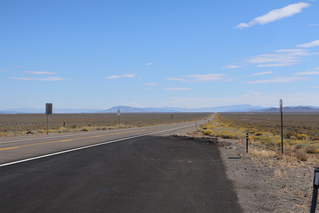 |
| Basin, Nevada, Monday |
While the rangey regions are more this sort of shape: |
| Range, Nevada, also Monday |
Much greener than the area around Battle Mountain too.
Through Austin and Eureka to Ely, home of the Hotel Nevada, which I've been meaning to take a photo of for years:
SCS Software went to the trouble of recreating the Hotel Nevada in American Truck Simulator, trivia fans.The last proper range lies between Ely and the junction with US-93, over Connors Pass which, at 7700-odd feet, is higher than anything I encountered crossing the Rockies in Montana. Go figure.
Large black clouds looming as I went south on US-93 and they actually started dropping enough rain for the wipers to be needed shortly before I stopped for more Petril™ in Panaca, having failed to close the gap between "miles to empty" and "miles to destination" sufficiently to get here chiz.
More of the same on NV-319, which turns into UT-56 when you cross the state line. The Best Western I stayed in the last time I was here in 2019 has turned into a Maverik Petril™ station so I am in the Best Western Plus over the road which is swankier but also more expensive.
Tomorrow there may be Scenery. Or not, if it rains.
- The Honda is not actually that Horrible but it's both slower to accelerate in "Sport" mode than the Beemer and drinks noticeably more Petril™, which sucks donkey balls.




No comments:
Post a Comment
O hai, spammers!
All comments are moderated so don't bother.
Kthxbai!