A large chunk of today's route did not happen, you understand, because they weren't on gravel roads where you ent supposed to take your hire car. So it's a good job I didn't, just like 2018 when I definitely didn't take the scenic route from Chicken to Dawson City, oh no.
Anyway, our intrepid explorers continued to head south in the hope of hooking up with the Shoshone and continued to not find them until mid-August 1805 at or near what they called Camp Fortunate. Sadly since then Camp Fortunate has been inundated with about eighty feet of water.
 |
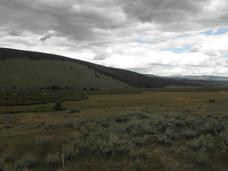
| Camp Fortunate is under this 'ere lake chiz. |
Anyway, they did finally meet the Shoshone, bought horses and made the trip over the Continental Divide at Lemhi Pass. It wasn't called that then, obv, because Lemhi is a figure from the Book of Mormon which Joseph Smith didn't make up until more than twenty years later. Lemhi Pass, were one to go there unlike, for e.g. me today, is reached from the Montana side by 12 miles of well-maintained gravel road and - apparently - passes this spot:
 |
| Picture by someone with a Garmin TwatNav & NHP BEAR who is not me |
If you were to ascend the pass , the view back into Montana might look like this:While the view into Idaho is said to look more like this:
 |
| "Downhill all the way now" exclaimed Captain Lewis... |
If one were to go straight on at the crossroads in the above photo then I've read that you will find yourself on another gravel road a fair bit more bumpy and a metric fucktonne steeper and twistier than the Montana side, so it's a good job I didn't go there. If I had gone there - which I didn't, natch - I'd have rejoined the tarmac in Tendoy ID and followed ID-28 down the Lemhi River valley to its meeting with the Salmon River in, er, Salmon. You can also get to Tendoy if, having not turned right to go over Lemhi Pass, you went straight on to the end of Highway 324 and turned right.
Horrible RTA in Baker, between Tendoy and Salmon. Multiple police cars, two or three ambulances and the Fire & Rescue mob with a van marked "EXTRICATION UNIT". Eeep.
Beyond the town of Salmon US-93 follows the river closely until suddenly it doesn't, Very like Captains Lewis and Clark. The river, you see, turns west and dives headlong into a canyon. Clark explored the first few miles of the canyon before returning disheartened, as the canyon was basically made of rapids impassable to either men on horseback or in the canoes which in their case they had not got. Instead they had to flog up the North Fork of the river which climbs steeply to the summit of Lost Trail Pass and drop down the other side into the Bitterroot Valley, which is these days back in Montana.
I took a bit of a detour here, turned right and back over the Divide to visit the Big Hole battlefield, scene of a barney between the US Army and the Nez Perce (pronounced NEZZ PURSE and not inna-French-stylee as I had thought until a few days ago). The Nez Perce, having been thoroughly stitched up by Whitey after gold was discovered on their reservation, decided in 1877 to bog off into Montana and hang out with their pals the Crow, but the revenge killin' of some, or more, settlers put the Army on their trail. The Nez Perce beat them convincingly at their first encounter at the foot of White Bird Hill south of Grangeville, but were attacked in the middle of the night at Big Hole and it took them quite a while to organise and give the military another bloody nose. Do not watch the film they show at the Visitor Center unless you want to get really fucking angry.
 |
| Nez Perce encampment was on the flat bit in the middle; US Army attacked from the left |
The Nez Perce changed their plans somewhat and decided the only place they'd be safe was Canada. Fighting a Several more battles along the way they made it to within forty miles of the border when they were defeated at the Battle of Bear Paw. Subsequently White Bird and a few men did make it into what's now Saskatchewan, but Chief Joseph and the rest of the Nez Perce surrendered, having been promised that they would be allowed to return to the reservation. Natch this also didn't happen, on the orders of General William Sherman, and instead they were marched all the way to Bismarck ND before going on by train to incarceration in Fort Leavenworth KS. The survivors, with the exception of Chief Joseph, were eventually allowed home in 1885; Joseph was not permitted to stay on the same reservation as the rest of his people. Though they did eventually name a dam on the Columbia River after him, so that's alright.
Why Lewis & Clark didn't carry on to the site of Missoula and turn west down the Clark Fork river is not entirely clear to this Unit, but they didn't. That, however, is tomorrow's adventure.


No comments:
Post a Comment
O hai, spammers!
All comments are moderated so don't bother.
Kthxbai!