Astoria is built like a sort of mini-San Francisco i.e. flat round the edges but reet lumpy once you get a few blocks away from the water. And at the top of the tallest hill is the Astoria Column, depicting useful factlets about the area includig its discovery by the non-natives. Captains J Cook RN and G Vancouver RN sailed up this stretch of the coast but didn't attempt to access the river, that honour falling instead to American Captain Robert Gray, who got here the hard way round Cape Horn in 1792 and named the river after his ship, the Columbia Rediviva.
 |
| The Astoria Column. Junior Pocket Microscope (model 3a) required to read carvings... |
 |
| Looking downriver from the Column |
 |
| Grays Bay (see above) |
Back down to sea level and back across the bridge into Washington. After escaping from Dismal Nitch the Corps of Discovery went a few miles further downriver to Station Camp, just west of the bridge site.
Ocian in view! O! the joy!
wrote Clark, with characteristically individualistic spelling. Though he wasn't actually at the "ocian" and didn't get there until a Several of days later, at Cape Disappointment. The cape was named by earlier seafaring chump John Meares, who mistook the river mouth for a large bay and carried on sailing south. Thus the Corps of Discovery did not become the first non-natives to cross the North American continent. Because Scotsman Alexander Mackenzie of the North West Company reached Bella Coola BC in 1793, but apart from having a gert big river named after him no-one's ever heard of the poor bugger.
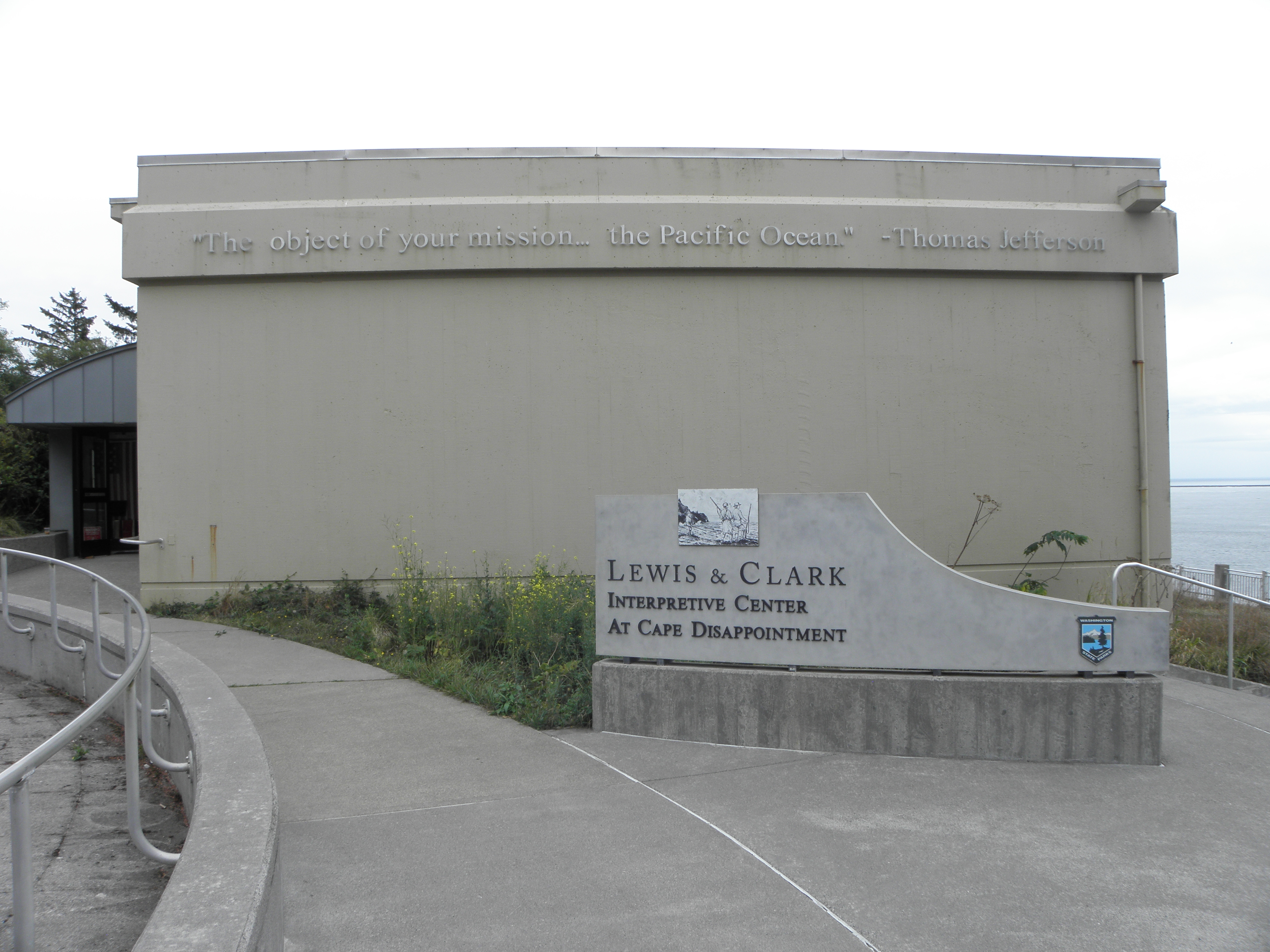
At Cape Disappointment there's a Visitor Center which charges five bucks to get into the Lewis & Clark section of the museum, on top of the ten they've already tried to charge you for parking. Their machine wouldn't work, not just for me but also for a Canadian chap and some locals, so I just stuck a note on the dashboard. The L&C bit is worth the price of admission; the freebie bit is mostly about the maritime side of Stuffs, with lots of details of the myriad wrecks that have occurred in the "Graveyard Of The Pacific".
 |
| A the Pacific Ocean, Wednesday. Beyond the ships1 lies Siberia. |
 |
| Roll call |
 |
| OK, we're here. Now what? |
Our wandering chums now faced the problem of where to spend the winter. The option existed of heading back inland but they were reluctant to do so as they were very short of salt, a necessity for preserving meat. The locals said the hunting was much better on the south side of the river so that was where they went. Much has been made of the fact that all members of the party were allowed their say in where to spend the winter, including both York and Sacagawea, but the expedition was above all a military one which in practice meant that whatever Lewis & Clark decided was what was going to happen. They backtracked a little upriver before crossing to the opposite side and heading up Youngs Bay to a suitable spot which they named "Fort Clatsop" after the local tribe. I did similar, with a detour to visit one o' they wrecks of which the museum spake:
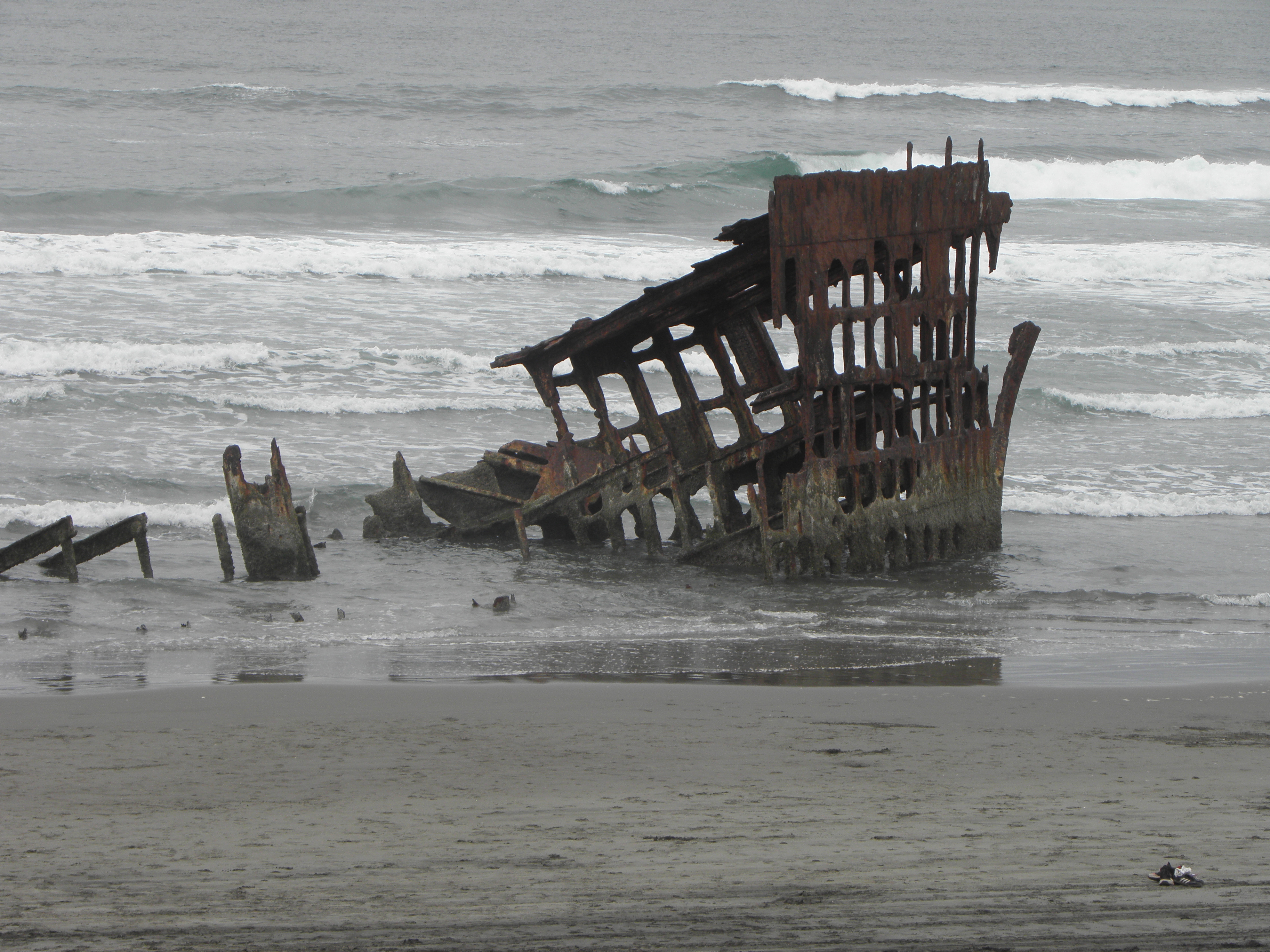 |
| The remains of the Peter Iredale which ran aground here in 1906 |
 |
| "Got any chips?" |
It's only a few miles to Fort Clatsop from there, though the Fort now standing there is a replica. The exact location of the original remains unknown since the area was settled and put to the plough in the 1850s. The layout is similar, but not identical to, Fort Mandan and the weather was lousy. they were there for three and a half months over the winter of 1805-6; it rained on all but twelve days and the sun appeared on only six. It's like Manchester. Ranger Jim2 was utterly baffled when a couple who showed up at the fort a minute after me turned out to be originally from Enfield and thus causing us to reminisce about Walthamstow Dog Track. They currently live in Vermont but are about to retire back to Blighty.
 |
| Fort Clatsop exterior |
 |
| The Captains' Lair, Fort Clatsop |
 |
| Lewis, J Random Native, Clark, Seaman the dogg of newfoundland breed and a flounder |
 |
| dogg of not the newfoundland breed cheesed off that she isn't allowed inside the Vistor Center |
And then they all went home. They had to wait up for a Several of weeks further upriver for the snow to disappear, after trying and failing to force a passage back through the Bitterroot Mountains. Once back at the foot of Lolo Pass Lewis and chums took a shortcut back over the Continental Divide and explored the Marias River before proceeding back down the Missouri. Clark and his half of the party more or less retraced their route back to Three Forks before crossing more mountains into the Yellowstone Valley, meeting back up with Lewis et al just below the meeting of the rivers. They reached St Louis in September 1806, having taken only six months to cover the distance.
Clark went on to have a successful career in politics as Governor of the Missouri Territory before his death in 1838. Lewis, in spite of being appointed Governor of the Louisiana Territory, did not fare as well and died of conspiracy theory only three years after the Expedition. Murder? Suicide? Some historians record, however, that Seaman the dogg of newfoundland breed was still at his side at the time of his death:
After the melancholy exit of Gov. Lewis, his dog would not depart for a moment from his lifeless remains; and when they were deposited in the earth no gentle means could draw him from the spot of interment. He refused to take every kind of food which was offered him, and actually pined away and died with grief upon his master's grave!
Thus concludes the travelogue or at least this bit of it, for upon the morrow I must hie me with all hastes to the south-east and Battle Mountain. Thus tomorrow's instalment will likely be even less content-free.
- Quite a long way beyond them, obv.
- ALL USAnian park rangers are called "Jim", even the women. It's like a law, or something.


No comments:
Post a Comment
O hai, spammers!
All comments are moderated so don't bother.
Kthxbai!